MyTopo
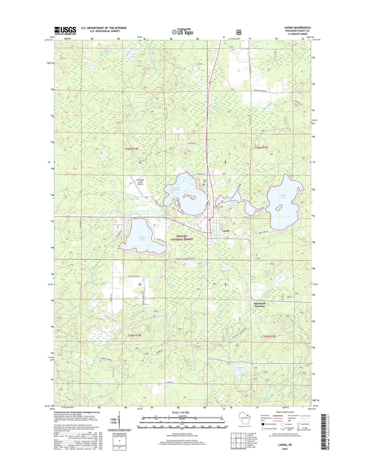
Laona Wisconsin US Topo Map
Couldn't load pickup availability
Also explore the Laona Forest Service Topo of this same quad for updated USFS data
2022 topographic map quadrangle Laona in the state of Wisconsin. Scale: 1:24000. Based on the newly updated USGS 7.5' US Topo map series, this map is in the following counties: Forest. The map contains contour data, water features, and other items you are used to seeing on USGS maps, but also has updated roads and other features. This is the next generation of topographic maps. Printed on high-quality waterproof paper with UV fade-resistant inks.
Quads adjacent to this one:
West: Lake Lucerne
Northwest: Crandon NE
North: Newald
Northeast: Lake Gordon
East: Blackwell
Southeast: Otter Lake
South: Wabeno
Southwest: Roberts Lake
This map covers the same area as the classic USGS quad with code o45088e6.
Contains the following named places: Birch Lake, Blackwell Junction, Bobs Creek, Bobs Lake, Camp Twenty Creek, Connor Forest Industries 1897C211 Dam, Flanners Creek, Heritage Acres Airport, Honey Creek, Kazmier Lake, Kokots Creek, Laona, Laona Cemetery, Laona Census Designated Place, Laona District Ranger Station, Laona Fire Department, Laona High School, Laona Lookout Tower, Laona Police Department, Laona Post Office, Laona Rescue Squad, Little Birch Lake, Robinson Elementary School, Scattered Rice Lake, Scattered Rice Lake 38, Silver Lake, Silver Lake Golf Course, Spring Pond, Swan Creek, Swanson Creek, Town of Laona, Town of Laona Beach and Public Picnic Area