MyTopo
Crandon Wisconsin US Topo Map
Couldn't load pickup availability
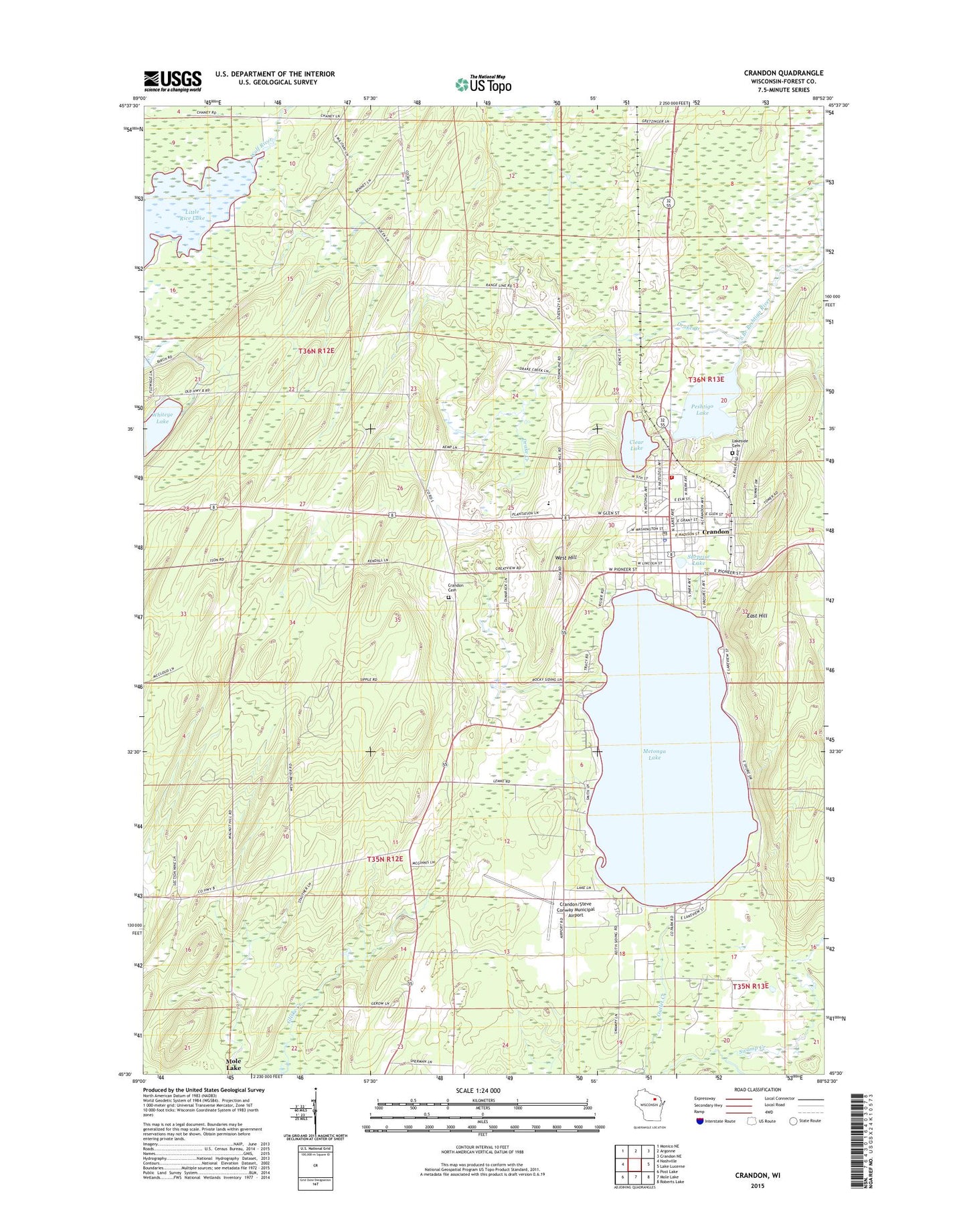
2022 topographic map quadrangle Crandon in the state of Wisconsin. Scale: 1:24000. Based on the newly updated USGS 7.5' US Topo map series, this map is in the following counties: Forest. The map contains contour data, water features, and other items you are used to seeing on USGS maps, but also has updated roads and other features. This is the next generation of topographic maps. Printed on high-quality waterproof paper with UV fade-resistant inks.
Quads adjacent to this one:
West: Nashville
Northwest: Monico NE
North: Argonne
Northeast: Crandon NE
East: Lake Lucerne
Southeast: Roberts Lake
South: Mole Lake
Southwest: Post Lake
This map covers the same area as the classic USGS quad with code o45088e8.
Contains the following named places: Church of God, City of Crandon, Clear Lake, Crandon, Crandon Alternative Resource School, Crandon Area Rescue Squad, Crandon Cemetery, Crandon City Hall, Crandon Elementary School, Crandon Fire Department, Crandon High School, Crandon Middle School, Crandon Police Department, Crandon Post Office, Crandon Townhall, Crandon/Steve Conway Municipal Airport, Drake Creek, East Hill, Forest County Courthouse, Forest County Fairground, Forest County Sheriff's Department, Hemlock Creek, Keith, Lakeland Baptist Church, Lakeside Cemetery, Little Rice State Wildlife Area, Metonga Lake, Metonga School, New Hope Christian School, Peshtigo Lake, Praise Chapel, Range School, Rhinelander Medical Center-Crandon Office, Saint Josephs Catholic Church, Saint Lukes United Methodist Church, Saint Pauls Lutheran Church, Sherman Corners, Sherman School, Siding Number 1 School, Siding Number 2 School, Spring Lake, Surprise Lake, Town of Crandon, Town of Nashville, Veteran Memorial Park, West Hill, Whiteye Lake, ZIP Code: 54520