MyTopo
Abbotsford Wisconsin US Topo Map
Couldn't load pickup availability
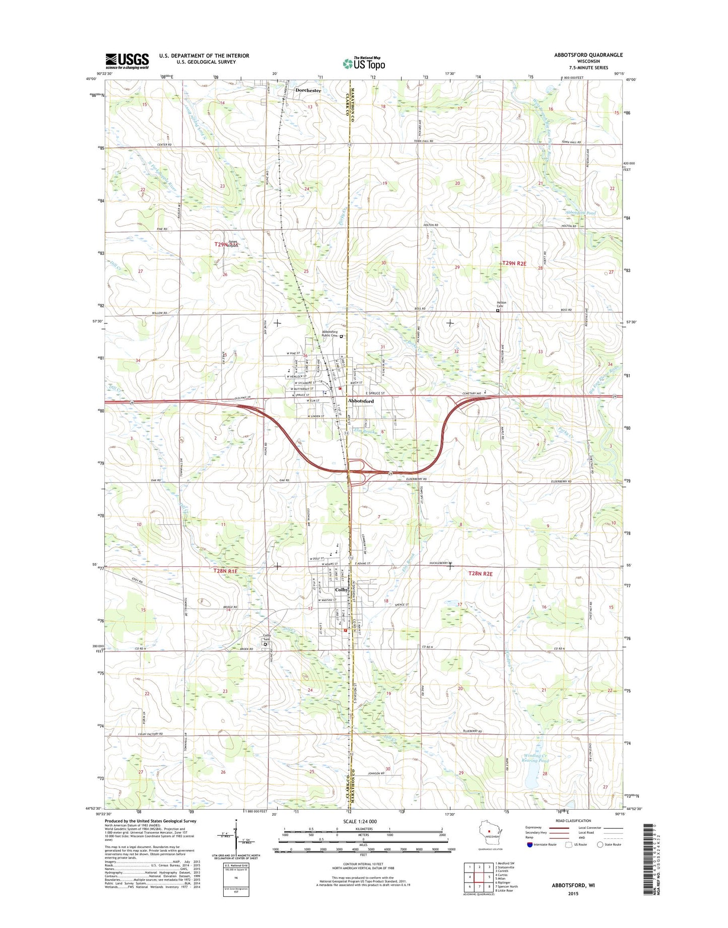
2022 topographic map quadrangle Abbotsford in the state of Wisconsin. Scale: 1:24000. Based on the newly updated USGS 7.5' US Topo map series, this map is in the following counties: Clark, Marathon. The map contains contour data, water features, and other items you are used to seeing on USGS maps, but also has updated roads and other features. This is the next generation of topographic maps. Printed on high-quality waterproof paper with UV fade-resistant inks.
Quads adjacent to this one:
West: Curtiss
Northwest: Medford SW
North: Stetsonville
Northeast: Corinth
East: Milan
Southeast: Little Rose
South: Spencer North
Southwest: Riplinger
This map covers the same area as the classic USGS quad with code o44090h3.
Contains the following named places: 13-29 Drive-In, 54405, 54421, Abbotsford, Abbotsford Cemetery, Abbotsford Christian Academy, Abbotsford Elementary School, Abbotsford Fire Department, Abbotsford Middle / High School, Abbotsford Police Department, Abbotsford Pond, Abbotsford Post Office, Abbotsford Wastewater Treatment Facility, Christ Lutheran Cemetery, City of Abbotsford, City of Colby, Colby, Colby Cemetery, Colby Elementary School, Colby High School, Colby Middle School, Colby Post Office, Colby Volunteer Fire Department, Colby Wastewater Treatment Plant, Colby-Abbotsford Airport, Elm Brook, First United Church of Christ, First United Presbyterian Church, Jones Airport, Pickard School, Pleasant Hill School, Porky Creek, Riverside School, Riverview Airport, Rosedale School, Saint Mary School, Saint Marys Catholic Church, Saint Pius X Monastery, Town of Holton, Town of Hull, Winding Creek Rearing Pond 1, Winding Creek Rearing Pond 3WR481 Dam