MyTopo
Loomis Wisconsin US Topo Map
Couldn't load pickup availability
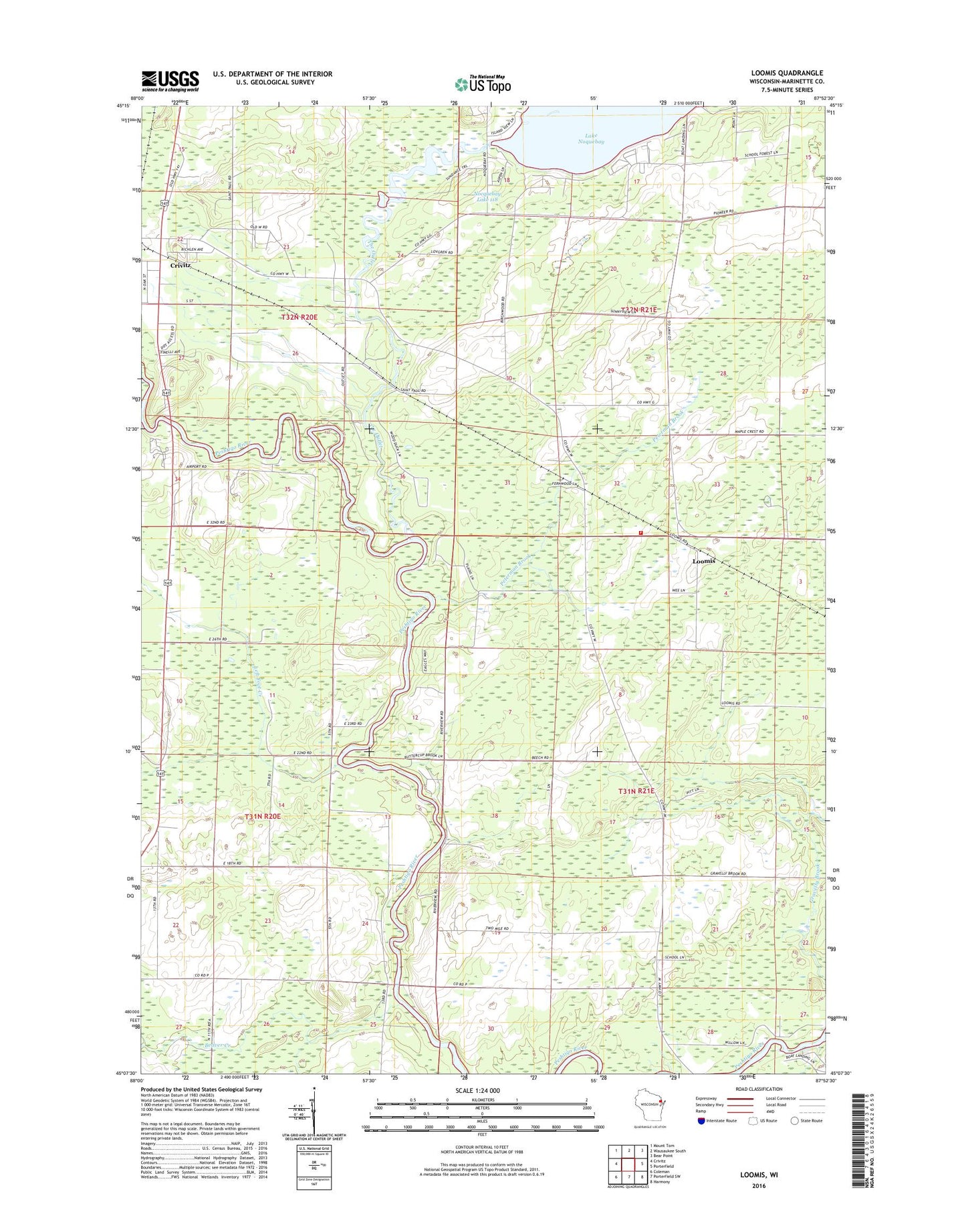
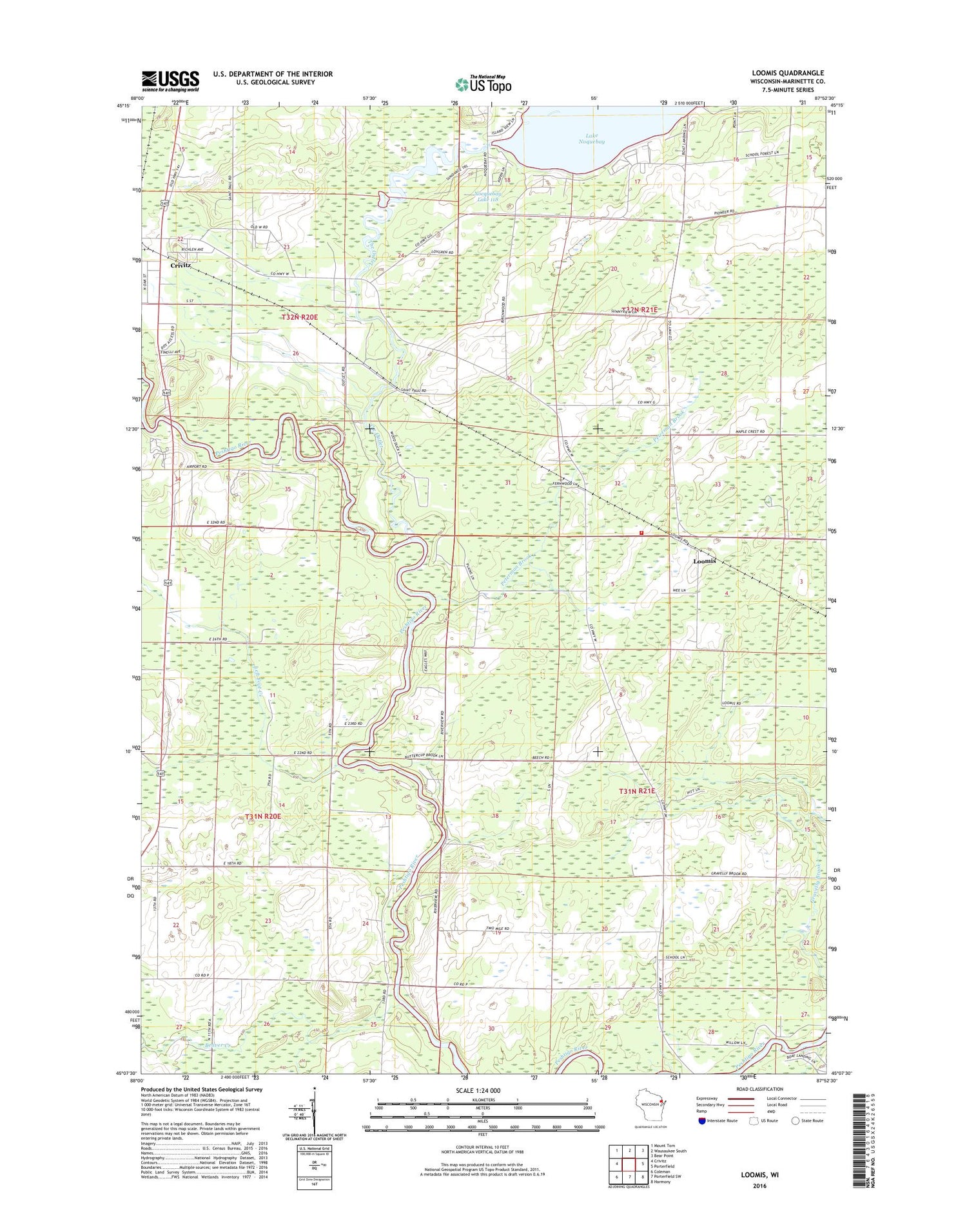
2018 topographic map quadrangle Loomis in the state of Wisconsin. Scale: 1:24000. Based on the newly updated USGS 7.5' US Topo map series, this map is in the following counties: Marinette. The map contains contour data, water features, and other items you are used to seeing on USGS maps, but also has updated roads and other features. This is the next generation of topographic maps. Printed on high-quality waterproof paper with UV fade-resistant inks.
Quads adjacent to this one:
West: Crivitz
Northwest: Mount Tom
North: Wausaukee South
Northeast: Bear Point
East: Porterfield
Southeast: Harmony
South: Porterfield SW
Southwest: Coleman
Contains the following named places: Beaver Creek, Lake Noquebay WP301 Dam, Lake School, Lake Volunteer Fire Department, Left Foot Creek, Loomis, Maple Grove School, Nocquebay Lake 118, North Branch Beaver Creek, Peterman Brook, South Branch Beaver Creek, The Outlet, Town of Lake, Wood School