MyTopo
Big Falls Wisconsin US Topo Map
Couldn't load pickup availability
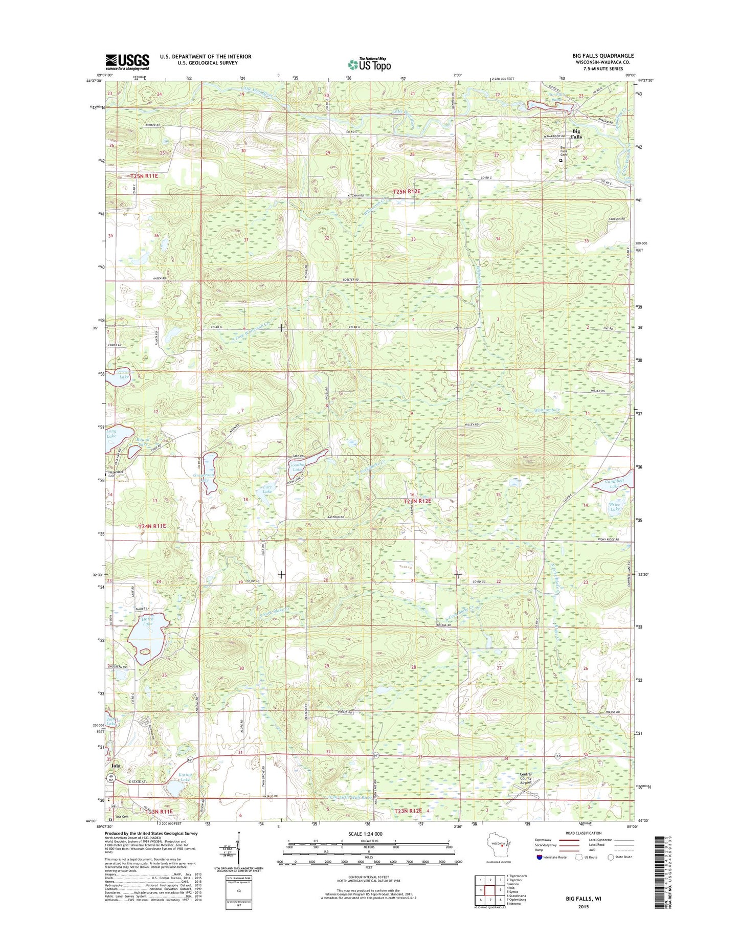
2022 topographic map quadrangle Big Falls in the state of Wisconsin. Scale: 1:24000. Based on the newly updated USGS 7.5' US Topo map series, this map is in the following counties: Waupaca. The map contains contour data, water features, and other items you are used to seeing on USGS maps, but also has updated roads and other features. This is the next generation of topographic maps. Printed on high-quality waterproof paper with UV fade-resistant inks.
Quads adjacent to this one:
West: Iola
Northwest: Tigerton NW
North: Tigerton
Northeast: Marion
East: Symco
Southeast: Manawa
South: Ogdensburg
Southwest: Scandinavia
This map covers the same area as the classic USGS quad with code o44089e1.
Contains the following named places: Big Falls, Big Falls 1907437 Dam, Big Falls Cemetery, Big Falls Dairy Farm, Big Falls Pond 160, Big Falls Post Office, Blake School, Campbell Lake, Central County Airport, Comet Creek, Dou School, Goodhal Lake, Grass Lake, Gregerson Lake, Hatch Lake, Hitterdahl Church, Hitterdahl Lutheran Cemetery, Iola - Scandinavia Elementary School, Iola Cemetery, Iola-Scandinavia High School, Kating Lake, Keller Whitcomb Creek Woods State Natural Area, Little Falls, Long Lake, Lutz Lake, North Fork Blake Creek, Price Lake, Round Lake, Schmidt Corner, Selmer School, South Fork Blake Creek, South Fork Whitcomb Creek, Spaulding Creek, Stony Ridge School, Thoe School, Town of Helvetia, Village of Big Falls, Village of Iola, Wyoming Guernsey Stock Farm