MyTopo
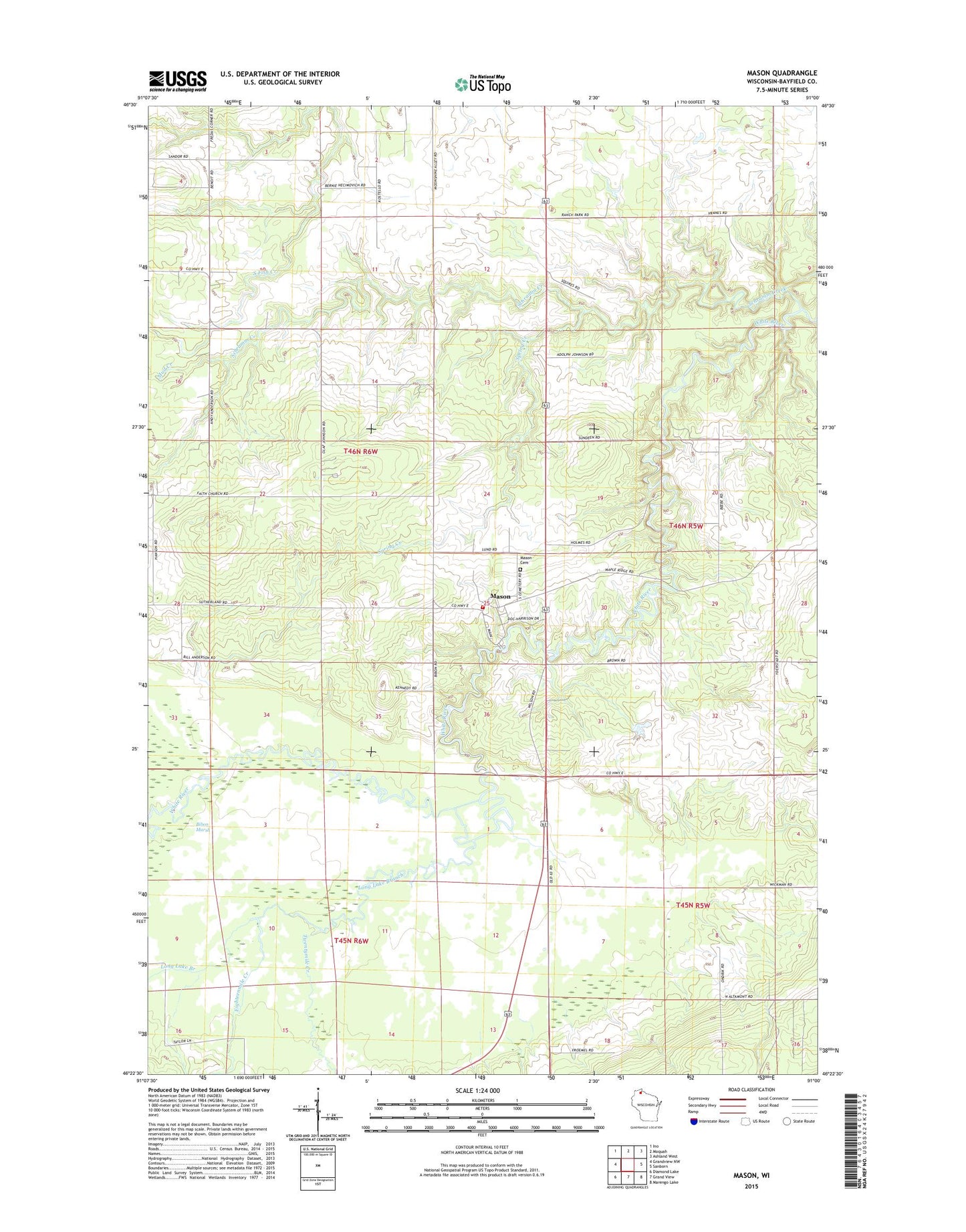
Mason Wisconsin US Topo Map
Couldn't load pickup availability
2018 topographic map quadrangle Mason in the state of Wisconsin. Scale: 1:24000. Based on the newly updated USGS 7.5' US Topo map series, this map is in the following counties: Bayfield. The map contains contour data, water features, and other items you are used to seeing on USGS maps, but also has updated roads and other features. This is the next generation of topographic maps. Printed on high-quality waterproof paper with UV fade-resistant inks.
Quads adjacent to this one:
West: Grandview NW
Northwest: Ino
North: Moquah
Northeast: Ashland West
East: Sanborn
Southeast: Marengo Lake
South: Grand View
Southwest: Diamond Lake
Contains the following named places: Bibon Marsh, Bibon Swamp State Natural Area, Eighteenmile Creek, Faith Church, Long Lake Branch, Mason, Mason Area Ambulance Service, Mason Cemetery, Mason Post Office, Mason Rural Fire Department, Mud Creek, Schramm Creek, Spring Creek, Town of Mason, Twentymile Creek, Village of Mason