MyTopo
McAllister Wisconsin US Topo Map
Couldn't load pickup availability
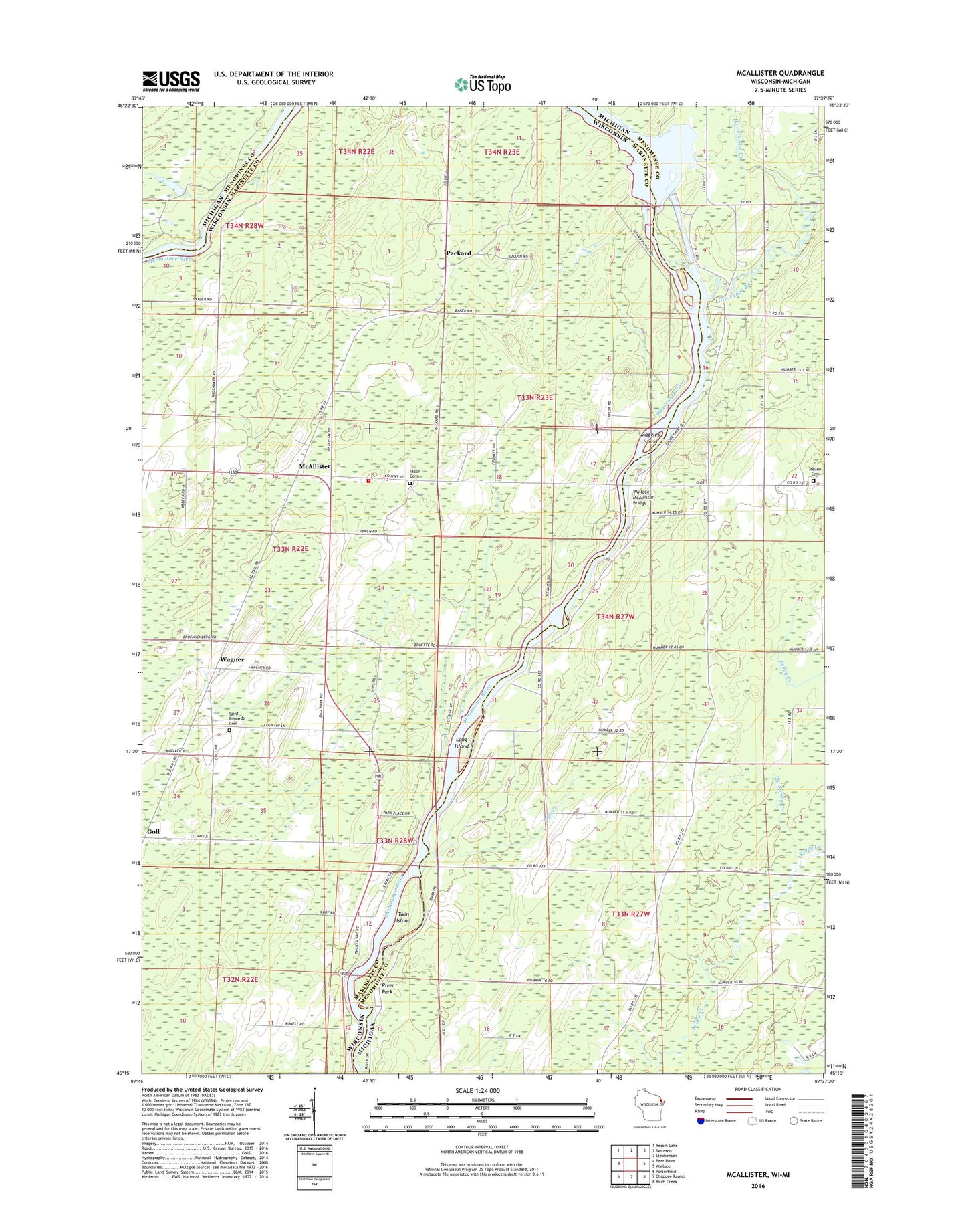
2018 topographic map quadrangle McAllister in the states of Wisconsin, Michigan. Scale: 1:24000. Based on the newly updated USGS 7.5' US Topo map series, this map is in the following counties: Marinette, Menominee. The map contains contour data, water features, and other items you are used to seeing on USGS maps, but also has updated roads and other features. This is the next generation of topographic maps. Printed on high-quality waterproof paper with UV fade-resistant inks.
Quads adjacent to this one:
West: Bear Point
Northwest: Resort Lake
North: Swanson
Northeast: Stephenson
East: Wallace
Southeast: Birch Creek
South: Chappee Rapids
Southwest: Porterfield
Contains the following named places: Big Spring Creek, Community Church, DeYoung Family Zoo, Grand Rapids Dam, Grand Rapids Flowage, Grand Rapids Flowage Number 1 Public Access, Little Cedar River, Little Kelley Creek, Long Island, Long Reach, Maggies Island, McAllister, McAllister School, Mellen Cemetery, Menominee River County Park, Packard, Pine Creek, River Park, River's Edge Adult Care Home, Saint Edwards Cemetery, Tabor Lutheran Cemetery, Town of Wagner, Twin Island, Twin Island Wayside Park, Wagner, Wagner Creek, Wagner Fire Department, Wagner Townhall, Wallace McAllister Bridge, Woesner Lake