MyTopo
Mead Lake West Wisconsin US Topo Map
Couldn't load pickup availability
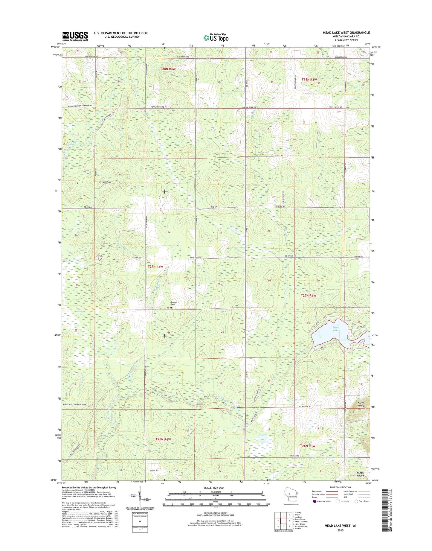
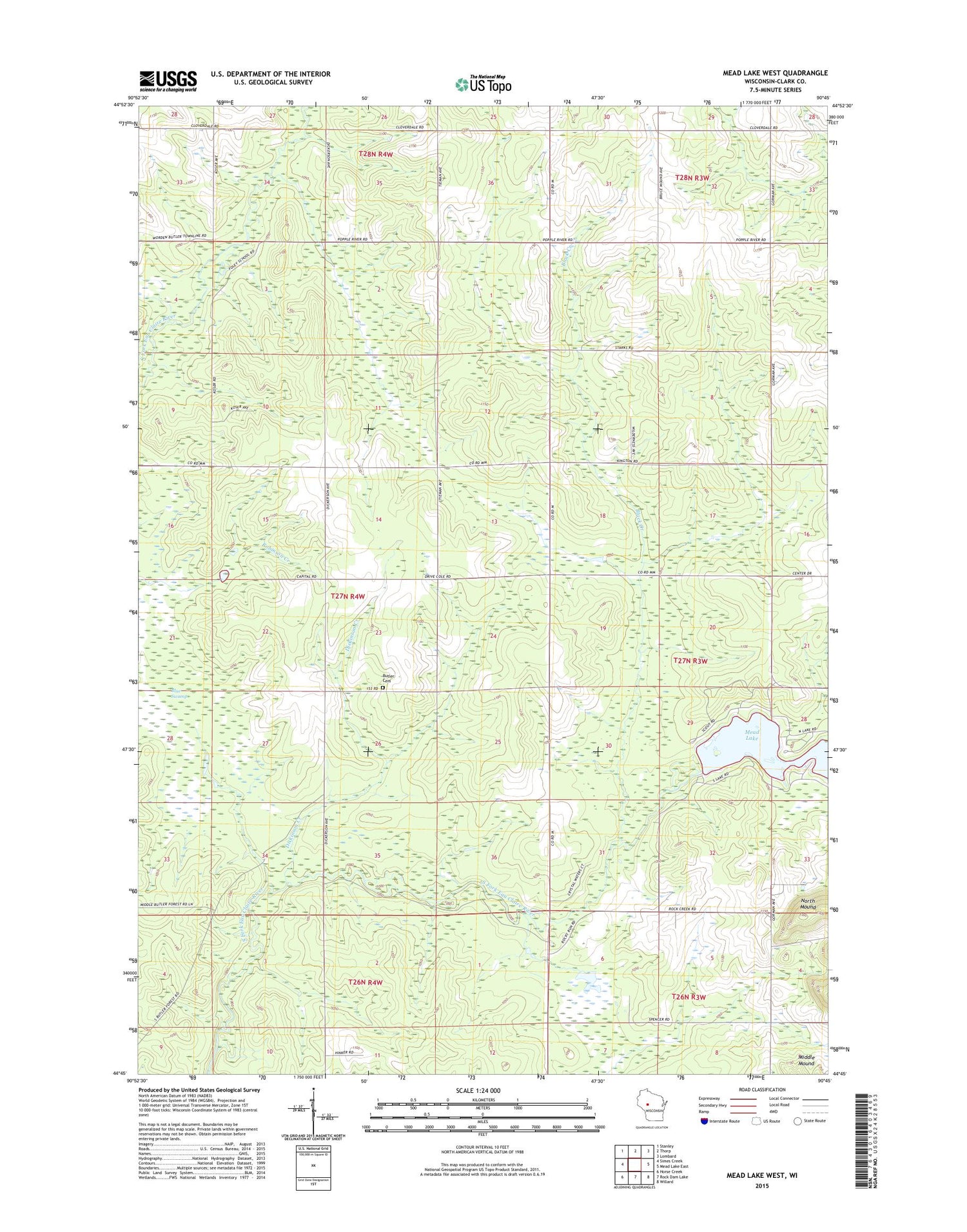
2018 topographic map quadrangle Mead Lake West in the state of Wisconsin. Scale: 1:24000. Based on the newly updated USGS 7.5' US Topo map series, this map is in the following counties: Clark. The map contains contour data, water features, and other items you are used to seeing on USGS maps, but also has updated roads and other features. This is the next generation of topographic maps. Printed on high-quality waterproof paper with UV fade-resistant inks.
Quads adjacent to this one:
West: Simes Creek
Northwest: Stanley
North: Thorp
Northeast: Lombard
East: Mead Lake East
Southeast: Willard
South: Rock Dam Lake
Southwest: Horse Creek
Contains the following named places: Black Creek, Blue Swamp, Blue Swamp State Natural Area, Butler Cemetery, Dickinson Creek, East Butler School, Mead 2WP862 Dam, Mead Lake, North Mead Lake County Park, Town of Butler, Veterans Memorial County Park Camp, West Butler School