MyTopo
Warrens West Wisconsin US Topo Map
Couldn't load pickup availability
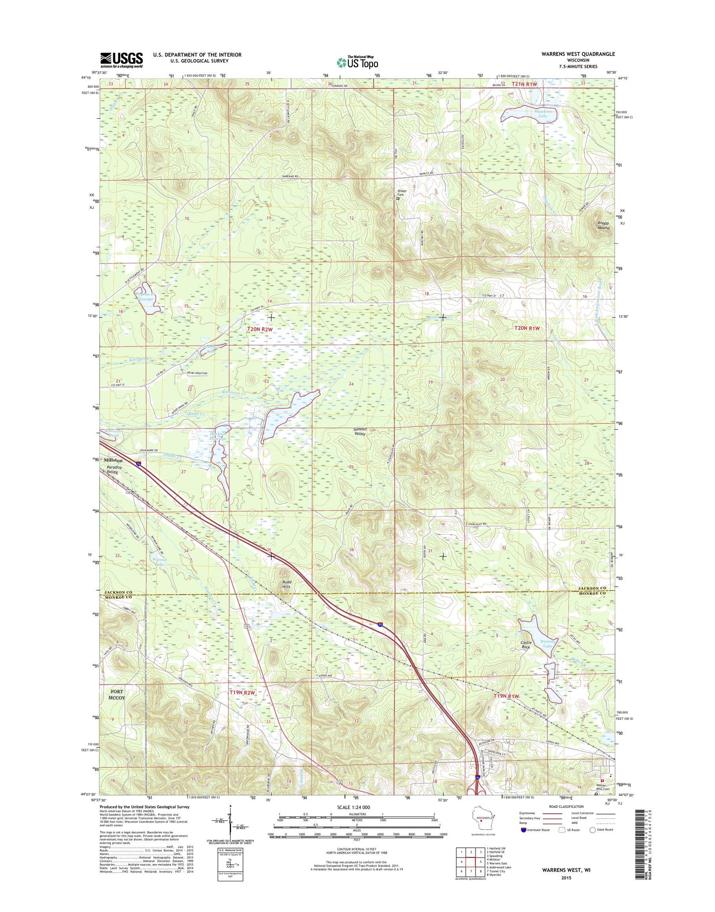
2022 topographic map quadrangle Warrens West in the state of Wisconsin. Scale: 1:24000. Based on the newly updated USGS 7.5' US Topo map series, this map is in the following counties: Jackson, Monroe. The map contains contour data, water features, and other items you are used to seeing on USGS maps, but also has updated roads and other features. This is the next generation of topographic maps. Printed on high-quality waterproof paper with UV fade-resistant inks.
Quads adjacent to this one:
West: Millston
Northwest: Hatfield SW
North: Hatfield SE
Northeast: Spaulding
East: Warrens East
Southeast: Wyeville
South: Tunnel City
Southwest: Alderwood Lake
This map covers the same area as the classic USGS quad with code o44090b5.
Contains the following named places: Castle Rock, Drescher School, Harkner 1 Dam, Harkner 2 Dam, Harkner Flowage, Hawkins Lake, Jay Creek Pine Forest State Natural Area, Ketchum Creek Pines State Natural Area, Ketchum Lake, Knapp Cemetery, Knapp Mound, Lake 23 15 6, Lake 27-1 6, McMullen Memorial County Park, Oakdale School, Paradise School, Paradise Valley, Pigeon Creek Flowage, Resettlement Administration 23 Dam, Robinson Pond, Rudd Creek, Rudd Hills, Saint Lukes Church, Town of Lincoln Fire Department, Town of Millston, Village of Warrens, Warrens Elementary School, Wazeda Lake, Wyman Lake