MyTopo
Miscauno Island Wisconsin US Topo Map
Couldn't load pickup availability
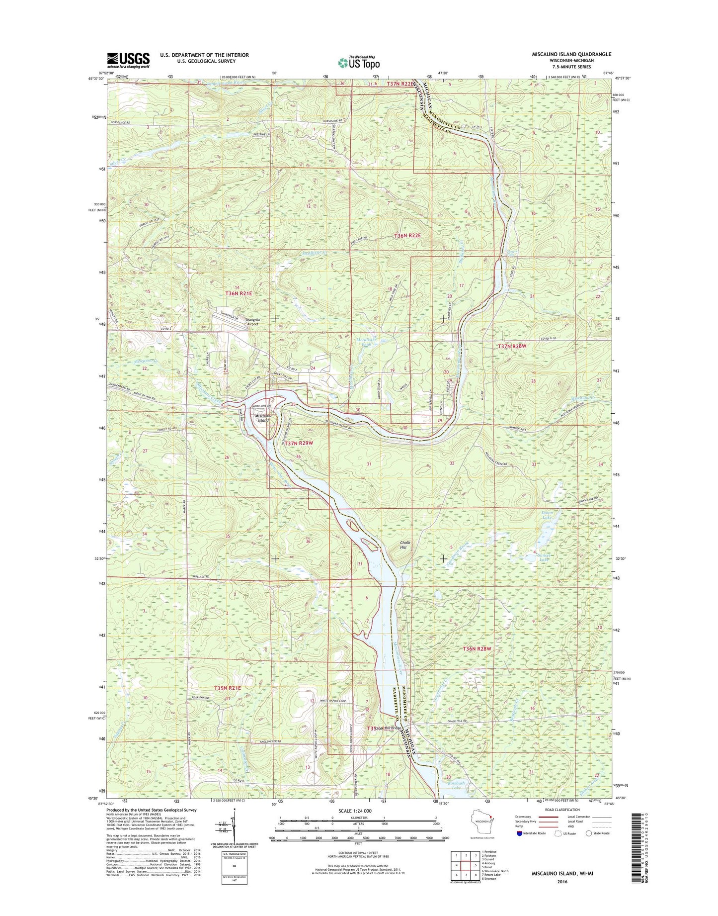
2018 topographic map quadrangle Miscauno Island in the states of Wisconsin, Michigan. Scale: 1:24000. Based on the newly updated USGS 7.5' US Topo map series, this map is in the following counties: Marinette, Menominee. The map contains contour data, water features, and other items you are used to seeing on USGS maps, but also has updated roads and other features. This is the next generation of topographic maps. Printed on high-quality waterproof paper with UV fade-resistant inks.
Quads adjacent to this one:
West: Amberg
Northwest: Pembine
North: Faithorn
Northeast: Cunard
East: Banat
Southeast: Swanson
South: Resort Lake
Southwest: Wausaukee North
Contains the following named places: Chalk Hill, Chalk Hill Bridge, Chalk Hill Dam, Chalk Hill Flowage, Chalk Hill Recreational Area Four, Chalk Hill Recreational Area Three, Dawn Lake, Goodman Brook, McAllister Creek, McAllister Pond, Miscauna Creek, Miscauno Creek, Miscauno Island, Mullaney Creek, Pemene Creek, Pemene Falls, Sawbridge Creek, Shangrila Airport, Silver Creek, Sunset Lake, White Pine Haven, White Rapids Church, White Rapids School