MyTopo
Monroe NW Wisconsin US Topo Map
Couldn't load pickup availability
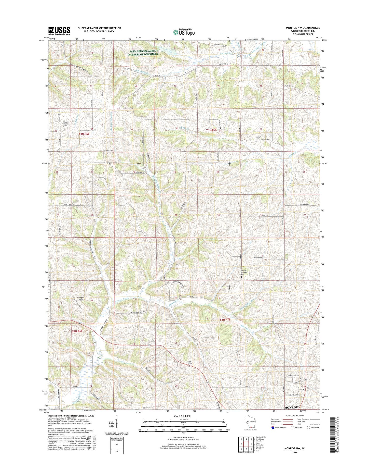
2018 topographic map quadrangle Monroe NW in the state of Wisconsin. Scale: 1:24000. Based on the newly updated USGS 7.5' US Topo map series, this map is in the following counties: Green. The map contains contour data, water features, and other items you are used to seeing on USGS maps, but also has updated roads and other features. This is the next generation of topographic maps. Printed on high-quality waterproof paper with UV fade-resistant inks.
Quads adjacent to this one:
West: Argyle
Northwest: Blanchardville
North: New Glarus
Northeast: Belleville
East: Monticello
Southeast: Juda
South: Monroe
Southwest: Browntown
Contains the following named places: Argus School, Argus School Branch, Benkert Bushnell Cemetery, Blackford School, Buckskin School, Buckskin School Creek, Bushnell Creek, Center Branch Hefty Creek, Flying H Airport, Garden Path Greenhouses, Hefty Creek, Iliff Cemetery, Iliff School, Lone Pine Dairy, Round Grove School, Shooks Prairie Cemetery, South Branch Hefty Creek, Torkelson Farm, Town of Monroe, Town of Washington, Union Benkert Cemetery, Washington Church, Weckerly Dairy, William Beers Dam