MyTopo
Monticello Wisconsin US Topo Map
Couldn't load pickup availability
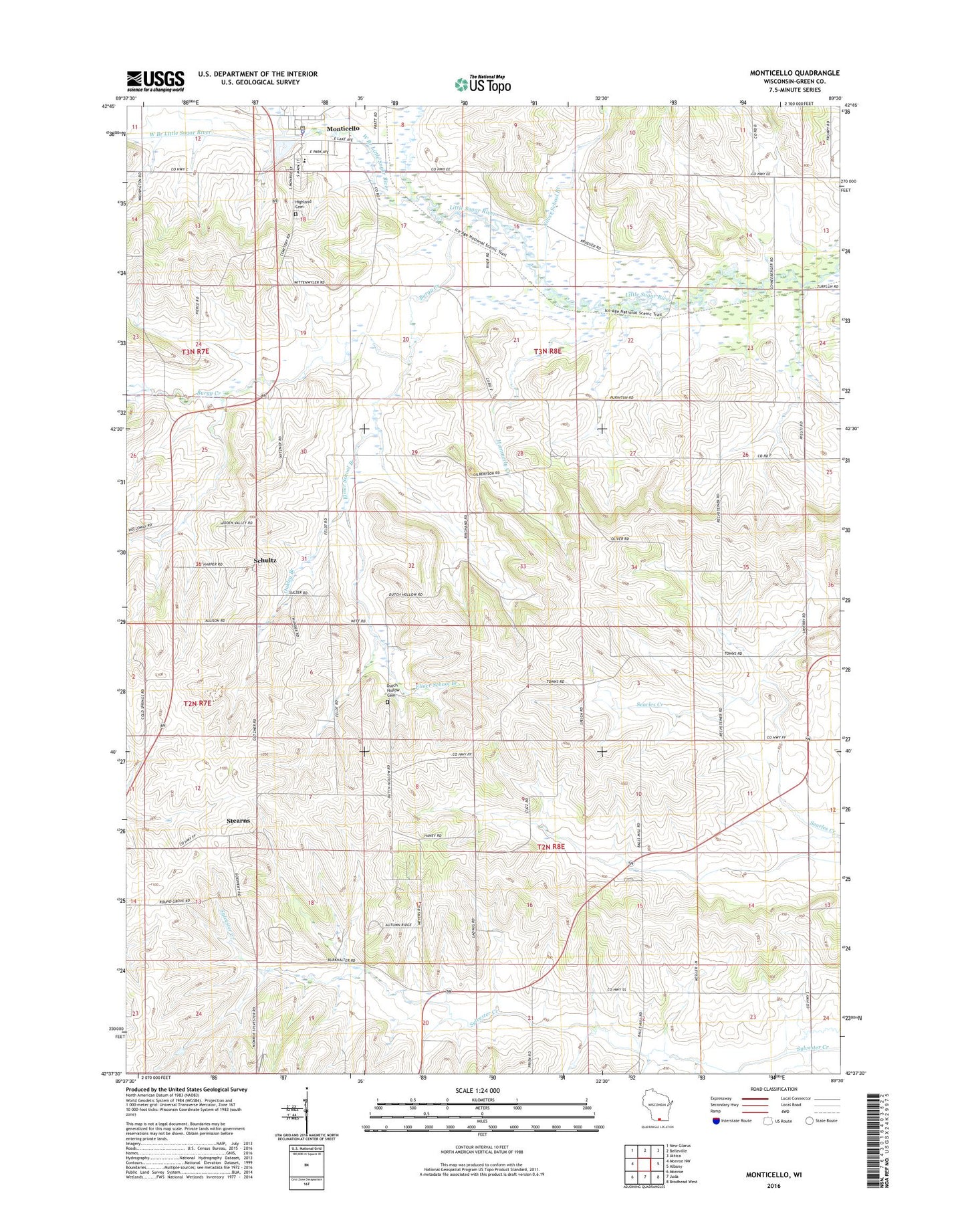
2022 topographic map quadrangle Monticello in the state of Wisconsin. Scale: 1:24000. Based on the newly updated USGS 7.5' US Topo map series, this map is in the following counties: Green. The map contains contour data, water features, and other items you are used to seeing on USGS maps, but also has updated roads and other features. This is the next generation of topographic maps. Printed on high-quality waterproof paper with UV fade-resistant inks.
Quads adjacent to this one:
West: Monroe NW
Northwest: New Glarus
North: Belleville
Northeast: Attica
East: Albany
Southeast: Brodhead West
South: Juda
Southwest: Monroe
This map covers the same area as the classic USGS quad with code o42089f5.
Contains the following named places: Albright Farms, Brugger Dairy, Brugger Farms, Burgy Creek, Dutch Hollow Cemetery, Elmer School Branch, Gempeler Farms, Grassroots Farm, Green County, Hammerly Creek, Hawks Hill Elk Ranch, Highland Cemetery, Hockland Dairy, Lake Montesian, Mahlkuch's Dairy, Malkow Farms, Monticello, Monticello Elementary School, Monticello High School, Monticello Middle School, Monticello Police Department, Monticello Post Office, Monticello Wastewater Treatment Facility, Pine Valley Farm, Pleasant Home Dairy, Prien Farms, Roe Farms, Schultz, Silver School Branch, Stearns, Swanson Farms, Town of Mount Pleasant, Town of Sylvester, Village of Monticello, West Branch Little Sugar River, Witt Farms, ZIP Code: 53570