MyTopo
Juda Wisconsin US Topo Map
Couldn't load pickup availability
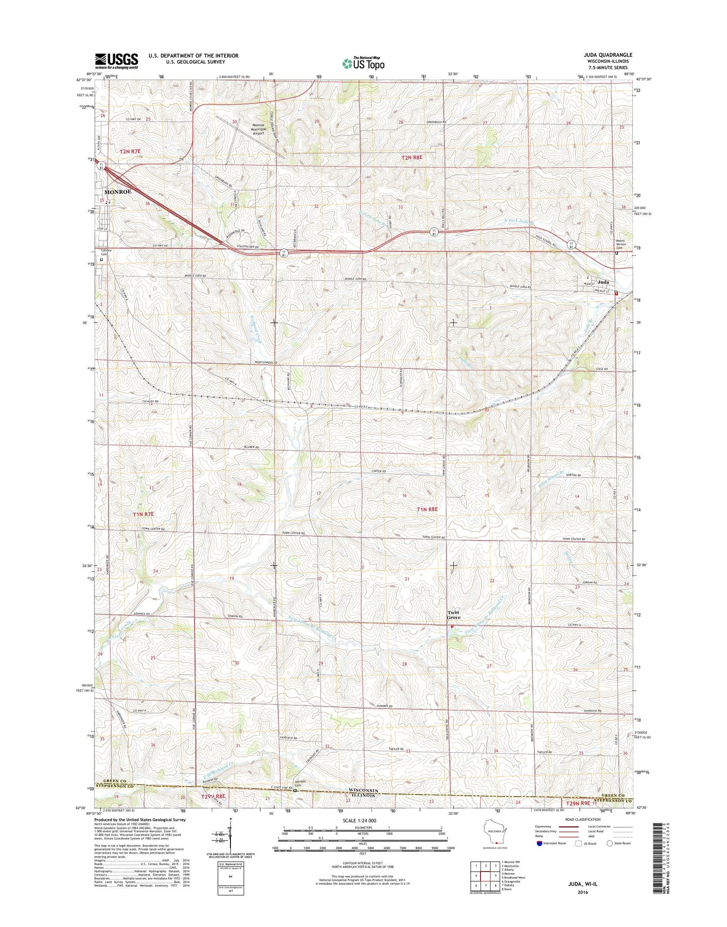
2022 topographic map quadrangle Juda in the state of Wisconsin. Scale: 1:24000. Based on the newly updated USGS 7.5' US Topo map series, this map is in the following counties: Green, Stephenson. The map contains contour data, water features, and other items you are used to seeing on USGS maps, but also has updated roads and other features. This is the next generation of topographic maps. Printed on high-quality waterproof paper with UV fade-resistant inks.
Quads adjacent to this one:
West: Monroe
Northwest: Monroe NW
North: Monticello
Northeast: Albany
East: Brodhead West
Southeast: Davis
South: Dakota
Southwest: Orangeville
This map covers the same area as the classic USGS quad with code o42089e5.
Contains the following named places: Ackerman Farm, Ball School, Barker Farms, Baumann Farms, Calvary Cemetery, Dein Acres, Devoe Farm, Eakins Farm, East Clarno School, Fairfield School, Green County Sheriff's Office, Johnson Cemetery, Jordan Acres, Juda, Juda Census Designated Place, Juda Community Fire Department Station 1, Juda Community Fire Station 2, Juda Elementary School, Juda High School, Juda Post Office, Mansfield Farm, Meier Farm, Monroe Emergency Response Inter - Agency Training Center, Monroe Independent Virtual Charter School, Monroe Municipal Airport, Monroe Virtual Charter Middle School, Mount Vernon Cemetery, North Fork Juda Branch, Northside Elementary School, Pleasant Grove School, Reed Farm, Richland School, Sacker Dairy Farm, Schmidt Farms, Speedbowl Quarry, Stuckey Dairy, Town of Jefferson, Twin Grove, Twin Grove Branch Richland Creek, Twin Grove School, WEKZ-AM (Monroe), Wyss Homestead Farm