MyTopo
Argyle Wisconsin US Topo Map
Couldn't load pickup availability
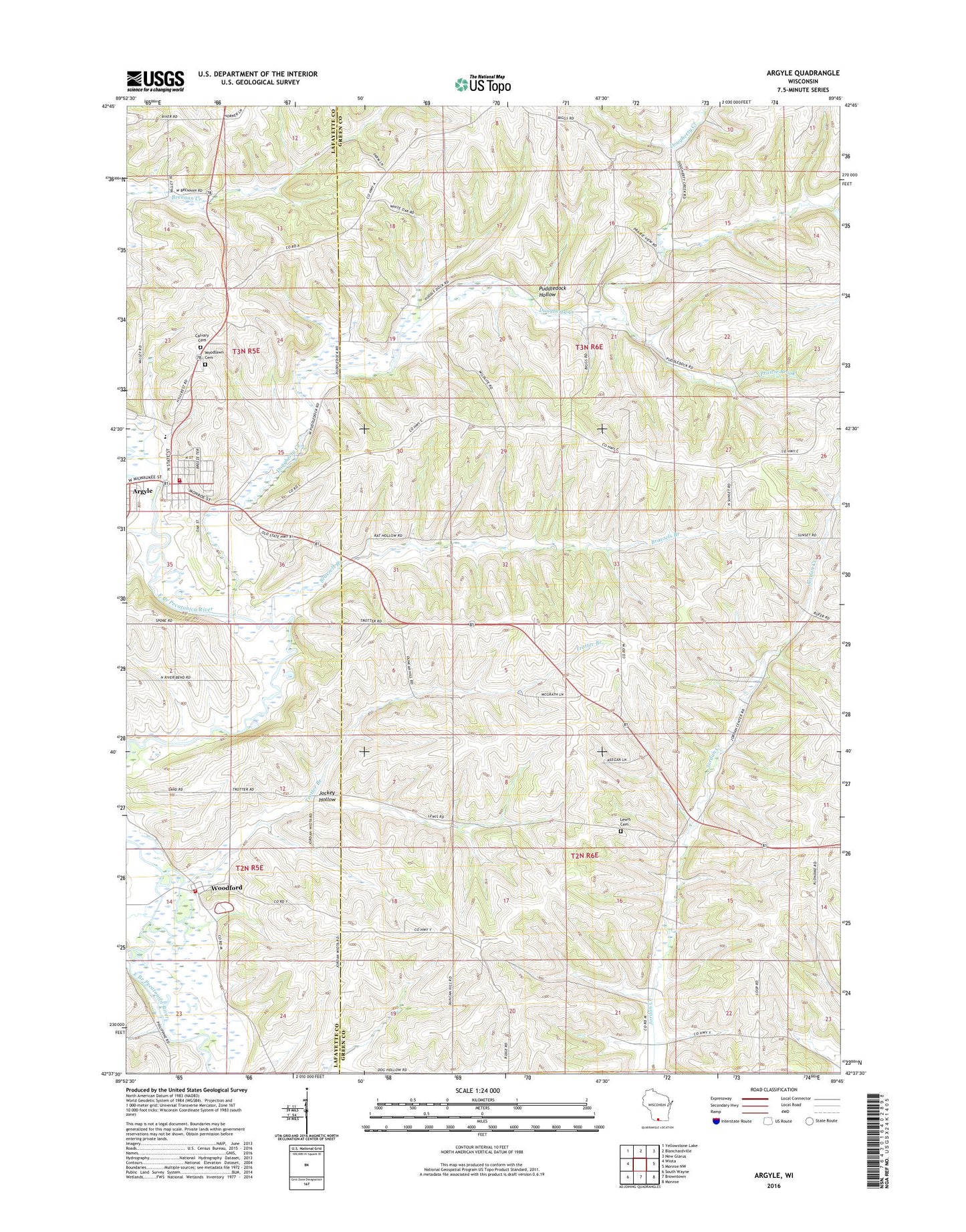
2022 topographic map quadrangle Argyle in the state of Wisconsin. Scale: 1:24000. Based on the newly updated USGS 7.5' US Topo map series, this map is in the following counties: Green, Lafayette. The map contains contour data, water features, and other items you are used to seeing on USGS maps, but also has updated roads and other features. This is the next generation of topographic maps. Printed on high-quality waterproof paper with UV fade-resistant inks.
Quads adjacent to this one:
West: Wiota
Northwest: Yellowstone Lake
North: Blanchardville
Northeast: New Glarus
East: Monroe NW
Southeast: Monroe
South: Browntown
Southwest: South Wayne
This map covers the same area as the classic USGS quad with code o42089f7.
Contains the following named places: Alea Argyle Land Ethic Academy, Argyle, Argyle Adams Community Fire Department, Argyle Elementary School, Argyle Emergency Medical Services, Argyle Police Department, Argyle Post Office, Argyle Schools, Argyle Wastewater Treatment Facility, Big Valley Farm, Braezels Branch, Calvary Cemetery, Cherry Branch, Dougherty Creek, Jockey Hollow, Jordan Center, Lewis Cemetery, Prairie Brook, Puddledock Hollow, Saint Francis Church, Saint Joseph Catholic Church, Town of Adams, Town of Jordan, Trotter Branch, Village of Argyle, Willet, Woodford, Woodford Census Designated Place, Woodford Post Office, Woodford Volunteer Fire Department, Woodlawn Cemetery, ZIP Codes: 53504, 53599