MyTopo
Retreat Wisconsin US Topo Map
Couldn't load pickup availability
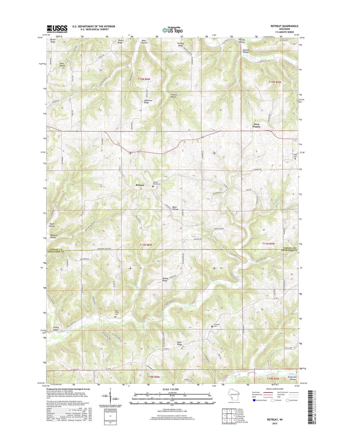
2022 topographic map quadrangle Retreat in the state of Wisconsin. Scale: 1:24000. Based on the newly updated USGS 7.5' US Topo map series, this map is in the following counties: Vernon, Crawford. The map contains contour data, water features, and other items you are used to seeing on USGS maps, but also has updated roads and other features. This is the next generation of topographic maps. Printed on high-quality waterproof paper with UV fade-resistant inks.
Quads adjacent to this one:
West: De Soto
Northwest: Genoa
North: Newton
Northeast: Viroqua
East: Rising Sun
Southeast: Mount Sterling
South: Ferryville
Southwest: Lansing
This map covers the same area as the classic USGS quad with code o43091d1.
Contains the following named places: 2 Reservoir, Anderson Ridge, Bad Axe 24 D 2592.1 Dam, Bean Hollow, Bishop Ridge, Bishop School, Bohland Hollow, Bristow Hollow, Bristow School, Brown Ridge, Brown School, Bull Run, Cooley Creek, Cooley Valley, Fargo Cemetery, Fortney Ridge, Freeman Cemetery, Freeman Church, Hornby Creek, Hornby Hollow, Lower Sugar Creek School, Nash Ridge, Nash Ridge School, Oak Ridge School, Prairie View Elementary School, Red Mound School, Reed, Retreat, Rush Creek Cemetery, Tewalt Ridge, Tewalt School, Torgerson Hollow, Town of Sterling, Upper Rush Creek School, Wakefield School, Walnut Mound Cemetery, West Prairie