MyTopo
Rising Sun Wisconsin US Topo Map
Couldn't load pickup availability
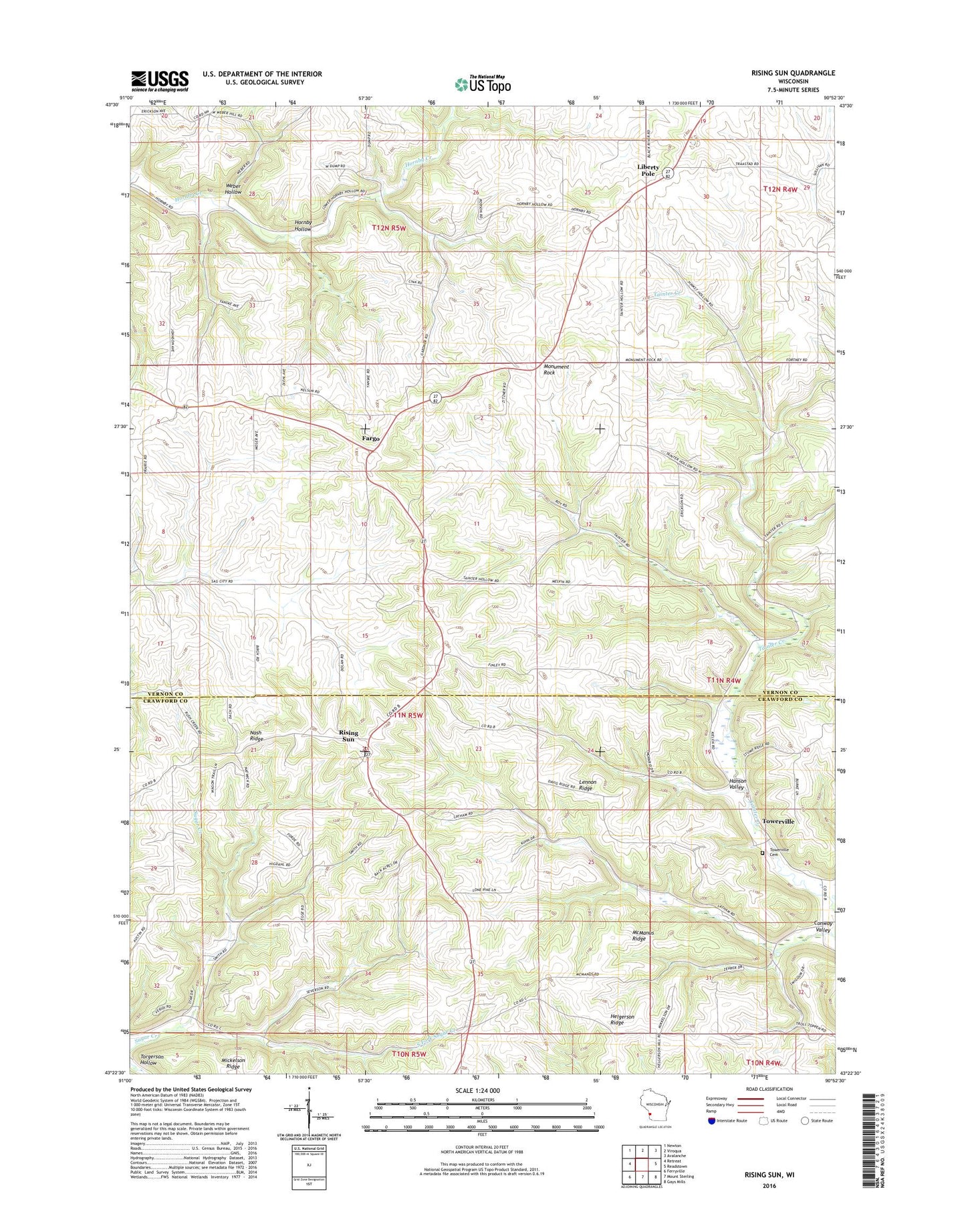
2022 topographic map quadrangle Rising Sun in the state of Wisconsin. Scale: 1:24000. Based on the newly updated USGS 7.5' US Topo map series, this map is in the following counties: Vernon, Crawford. The map contains contour data, water features, and other items you are used to seeing on USGS maps, but also has updated roads and other features. This is the next generation of topographic maps. Printed on high-quality waterproof paper with UV fade-resistant inks.
Quads adjacent to this one:
West: Retreat
Northwest: Newton
North: Viroqua
Northeast: Avalanche
East: Readstown
Southeast: Gays Mills
South: Mount Sterling
Southwest: Ferryville
This map covers the same area as the classic USGS quad with code o43090d8.
Contains the following named places: 0.36 Reservoir, 2 Reservoir, 6 Reservoir, Bad Axe 16 D 2592.1 Dam, Bad Axe 17 D 2592.1 Dam, Cass School, Conley School, Conway Valley, Fargo, Gardner School, Hanson Valley, Lawson G 9125 Dam, Lennon Ridge, Liberty Pole, Liberty Pole Elementary School, Liberty Pole United Methodist Church, Lynn School, McManus Ridge, Monument Rock, Propwash Field, Rising Sun, Rising Sun School, Saint James Church, South Fork Sugar Creek, Southwest Prairie Church, Star Valley School, Towerville, Towerville Cemetery, Towerville School, Town of Franklin, Tully School, Upper Sugar Creek School, Weber Hollow, Weber School, West Prairie Church