MyTopo
Westfield East Wisconsin US Topo Map
Couldn't load pickup availability
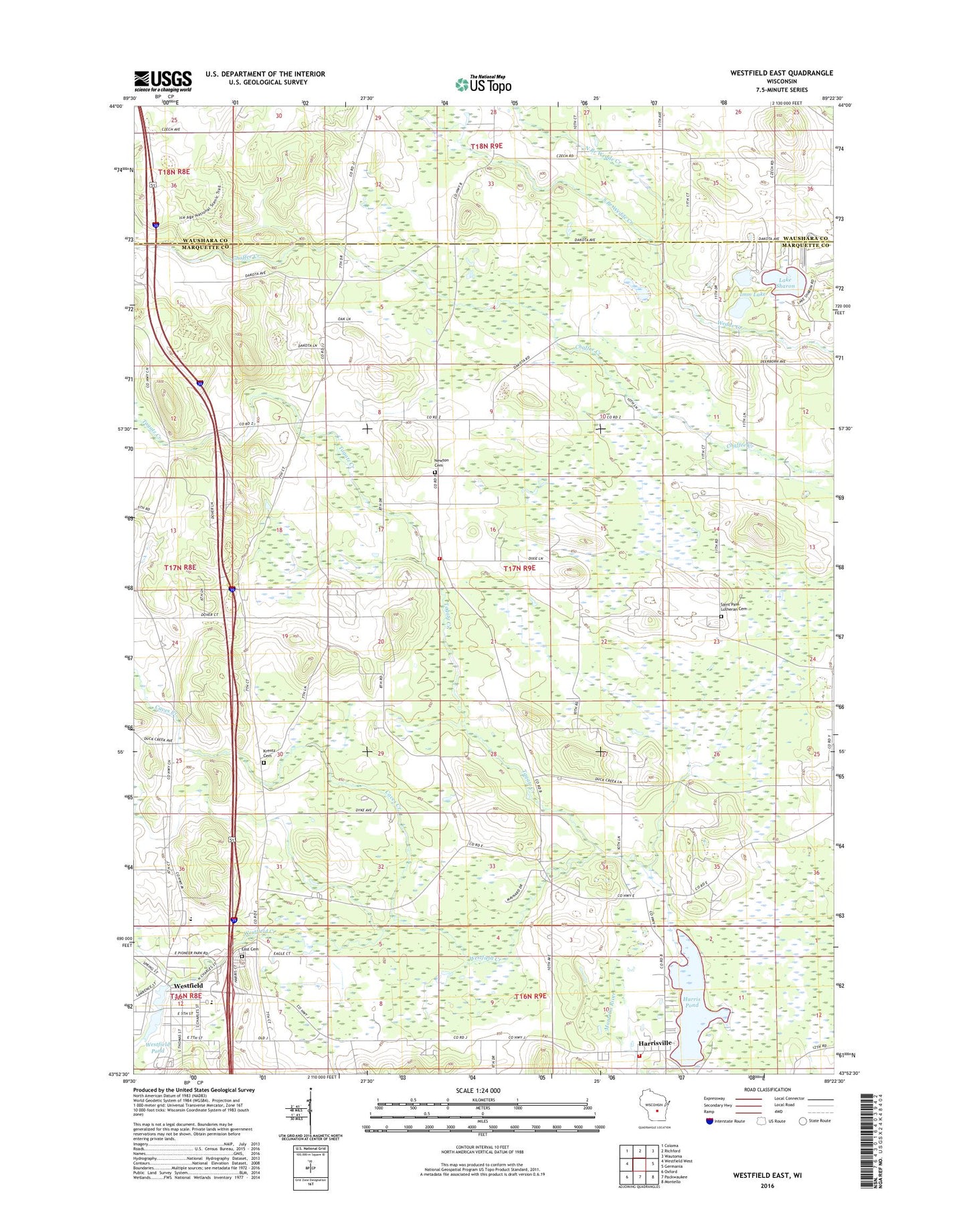
2022 topographic map quadrangle Westfield East in the state of Wisconsin. Scale: 1:24000. Based on the newly updated USGS 7.5' US Topo map series, this map is in the following counties: Marquette, Waushara. The map contains contour data, water features, and other items you are used to seeing on USGS maps, but also has updated roads and other features. This is the next generation of topographic maps. Printed on high-quality waterproof paper with UV fade-resistant inks.
Quads adjacent to this one:
West: Westfield West
Northwest: Coloma
North: Richford
Northeast: Wautoma
East: Germania
Southeast: Montello
South: Packwaukee
Southwest: Oxford
This map covers the same area as the classic USGS quad with code o43089h4.
Contains the following named places: Caves Creek, East Cemetery, Faith United Methodist Church, Good Shepherd Catholic Church, Harris Pond, Harris Pond 78, Harris Volunteer Fire Department, Harrisville, Harrisville Census Designated Place, Harrisville Dam, Imm Lake, Immanuel Lutheran Church, Krentz Cemetery, Lake Sharon, Marquette County Emergency Medical Services Westfield Branch, Newton Cemetery, Newton Church, Newton Volunteer Fire Department, North Branch Wedde Creek, Pioneer Westfield Middle School, Saint Paul Lutheran Cemetery, South Branch Wedde Creek, Springfield Corners, Tagatz Creek, Town of Newton, Upper Fox Headwaters State Natural Area, Village of Westfield, Westfield, Westfield Area Middle School - High School, Westfield Creek, Westfield Dam, Westfield Elementary School, Westfield Police Department, Westfield Pond 9, Westfield Post Office, Westfield Volunteer Fire Department