MyTopo
Town Corner Lake Wisconsin US Topo Map
Couldn't load pickup availability
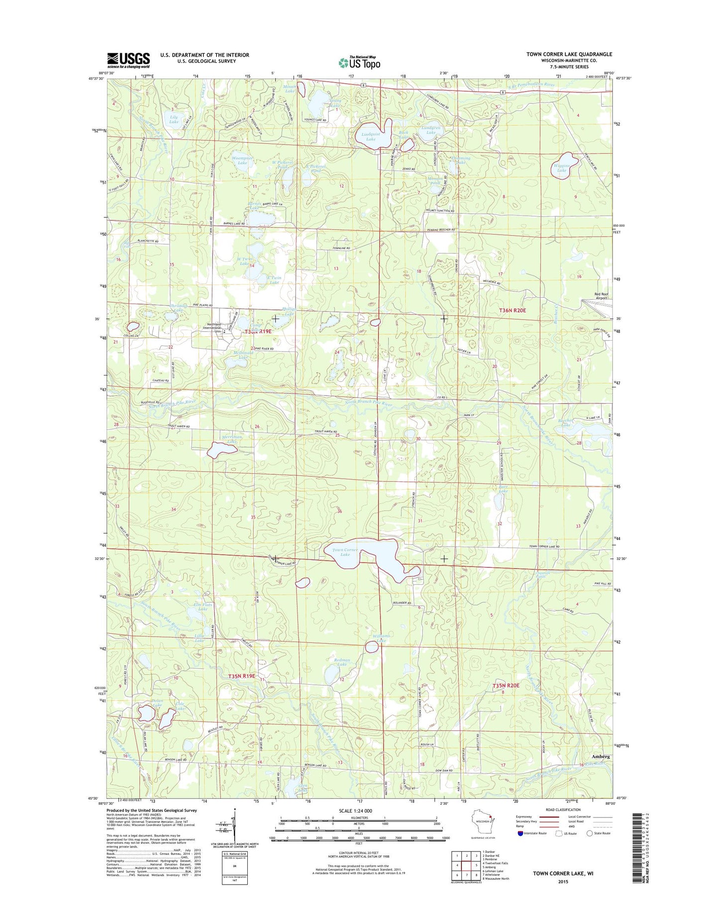
2022 topographic map quadrangle Town Corner Lake in the state of Wisconsin. Scale: 1:24000. Based on the newly updated USGS 7.5' US Topo map series, this map is in the following counties: Marinette. The map contains contour data, water features, and other items you are used to seeing on USGS maps, but also has updated roads and other features. This is the next generation of topographic maps. Printed on high-quality waterproof paper with UV fade-resistant inks.
Quads adjacent to this one:
West: Twelvefoot Falls
Northwest: Dunbar
North: Dunbar NE
Northeast: Pembine
East: Amberg
Southeast: Wausaukee North
South: Athelstane
Southwest: Lehman Lake
This map covers the same area as the classic USGS quad with code o45088e1.
Contains the following named places: Back Lake, Barnes Lake, Barr Lake, Beecher Church, Beecher Lake, Beecher Lake 3WR1552 Dam, Bull Falls, Camp Lake, Chipmunk Rapids, Christian Lake, Cole Creek, Cole Lake, Coons School, Dolan Lake, East Pickerel Pond, East Twin Lake, Elm Flats Lake, Lillie Lake, Lily Lake, Lindquist Lake, Lundgren Lake, McDonald Lake, Merriman Lake, Merriman School, Minnie Lake, Monson Pond, North Branch Pike River, Northland Scholars Academy, Phillips Lake, Pike Ridge School, Red Roof Airport, Redman Lake, Smeester School, South Branch Pike River, Thoeming Lake, Town Corner Creek, Town Corner Lake, Town Corner State Wildlife Management Area, Upper Lake, West Pickerel Pond, West Twin Lake, Whiskey Creek, Wiggins Lake, Williams Lake, Woempner Lake, Young Lake