MyTopo
Pepin Wisconsin US Topo Map
Couldn't load pickup availability
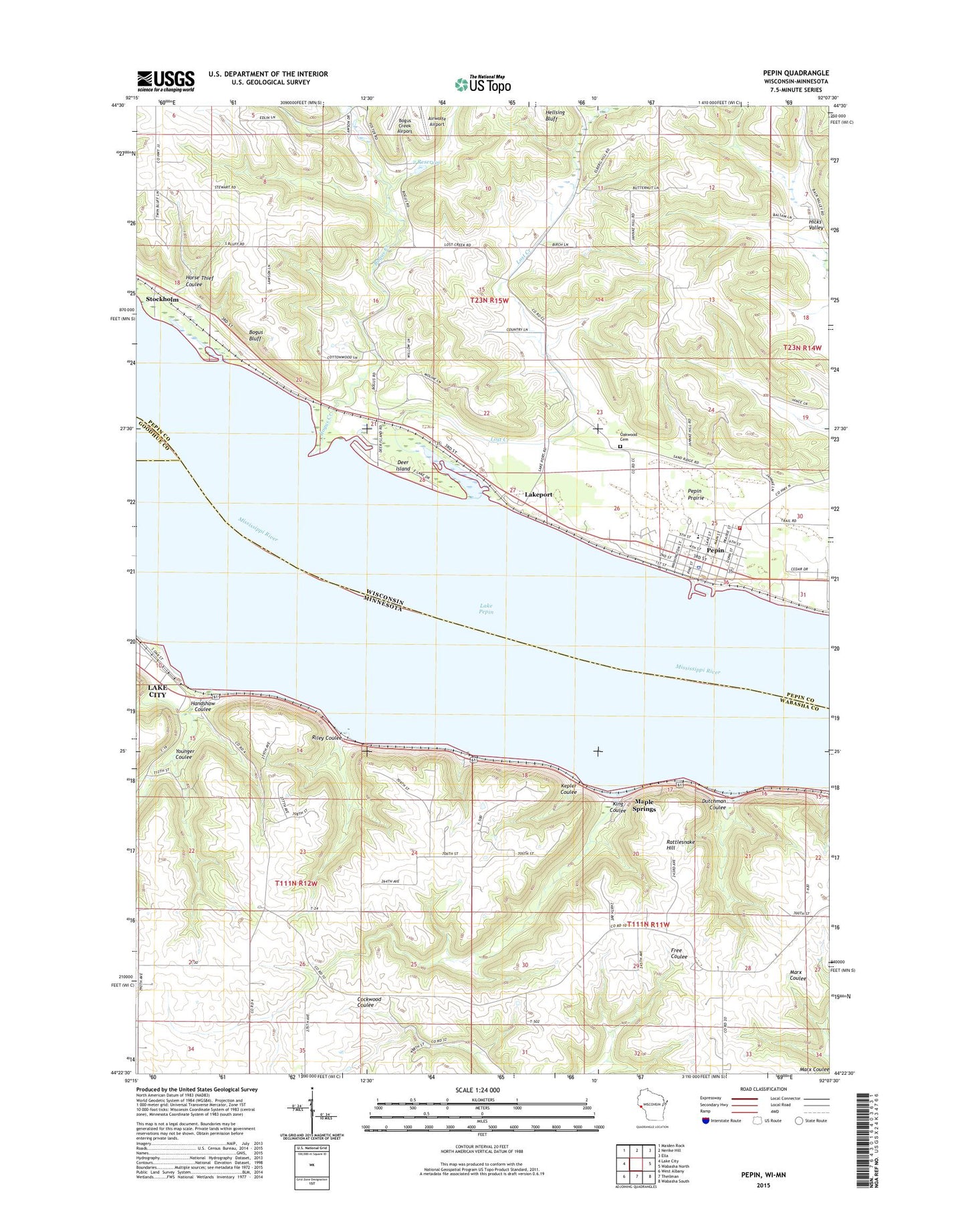
2022 topographic map quadrangle Pepin in the states of Wisconsin, Minnesota. Scale: 1:24000. Based on the newly updated USGS 7.5' US Topo map series, this map is in the following counties: Pepin, Wabasha, Goodhue. The map contains contour data, water features, and other items you are used to seeing on USGS maps, but also has updated roads and other features. This is the next generation of topographic maps. Printed on high-quality waterproof paper with UV fade-resistant inks.
Quads adjacent to this one:
West: Lake City
Northwest: Maiden Rock
North: Nerike Hill
Northeast: Ella
East: Wabasha North
Southeast: Wabasha South
South: Theilman
Southwest: West Albany
This map covers the same area as the classic USGS quad with code o44092d2.
Contains the following named places: 2 Reservoir, 54759, Airwolfe Airport, Bogus Bluff, Bogus Creek, Bogus Creek 1 D-9133 Dam, Deer Island, Deer Lake, Dutchman Coulee, Handshaw Coulee, Horse Thief Coulee, Kepler Coulee, King Coulee, Lake Pepin, Lakeport, Lost Creek, Lost Creek 3 D-31.10 Dam, Lost Creek 4 D 31.10 Dam, Lost Creek 5 D 31.10 Dam, Maple Springs, Miller Creek, Oakwood Cemetery, Pepin, Pepin County, Pepin Elementary School, Pepin Emergency Ambulance Service, Pepin Fire Department, Pepin High - Middle School, Pepin Police Department, Pepin Post Office, Pepin Prairie, Rattlesnake Hill, Riley Coulee, Town of Pepin, Township of Lake, Township of Pepin, Village of Pepin, West Lost Creek, Younger Coulee