MyTopo
Wabasha North Minnesota US Topo Map
Couldn't load pickup availability
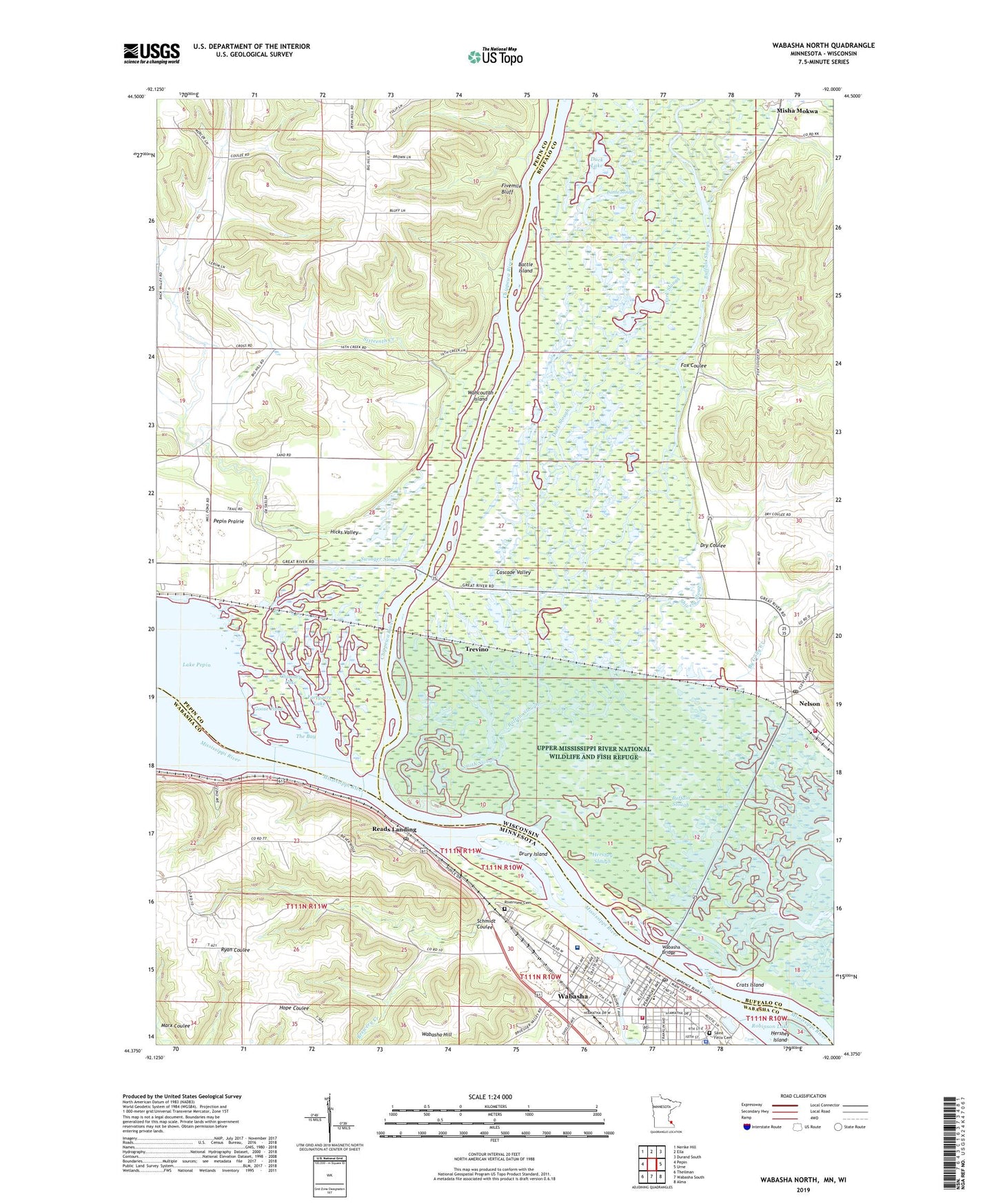
2022 topographic map quadrangle Wabasha North in the states of Wisconsin, Minnesota. Scale: 1:24000. Based on the newly updated USGS 7.5' US Topo map series, this map is in the following counties: Wabasha, Buffalo, Pepin. The map contains contour data, water features, and other items you are used to seeing on USGS maps, but also has updated roads and other features. This is the next generation of topographic maps. Printed on high-quality waterproof paper with UV fade-resistant inks.
Quads adjacent to this one:
West: Pepin
Northwest: Nerike Hill
North: Ella
Northeast: Durand South
East: Urne
Southeast: Alma
South: Wabasha South
Southwest: Theilman
Contains the following named places: 0.07 Reservoir, 55968, Battle Island, Battle Slough, Beach Park, Brewery Creek, Buffalo Slough, By Golly Creek, Camp Lacupolis, Chimney Lake, Chippewa River, Chippewa Turnout Park, Crats Island, Dark Slough, Drury Island, Dry Coulee, Duck Lake, Faith Lutheran Church, Fivemile Bluff, Five-Mile Bluff Prairie State Natural Area, Fortyacre Lake, Fox Coulee, Geology of Lake Pepin Historical Marker, Goose Pond, Government Light Slough, Grace Memorial Episcopal Church, Hershey Island, Hershey Slough, Hiawatha Bible Chapel, Hicks Valley, Indian Slough, Izaak Walton Park, Kellogg Police Department, Lake Pepin Historical Marker, Little Bear Creek, Malone Park, Minnesota Map Historical Marker, Misha Mokwa, Mississippi Parkside Marina, Nelson, Nelson Post Office, Nelson Volunteer Fire Company, Nelson-Trevino Bottoms State Natural Area, Parent Slough, Pontoon Slough, Reads Landing, Reads Landing Overlook, Reads Landing Park, Reads Landing Post Office, Richard H Jahnke 904 Dam, Riverview Cemetery, Saint Elizabeth Health Care Center, Saint Elizabeth's Medical Center, Saint Felix Catholic School, Saint Felix Cemetery, Saint Felix Church, Saint Paul's United Church, Schmidt Coulee, Shively Slough, Sixteenth Creek, Smith Slough, Swift Slough, Swinger Slough, The Bay, Tiffany Bottoms State Natural Area, Tiffany State Public Hunting Grounds, Trevino, Truedale Lake, United Church of Christ, Village of Nelson, Wabasha, Wabasha Ambulance Service, Wabasha Bridge, Wabasha City Hall, Wabasha City Library, Wabasha Clinic, Wabasha County Courthouse, Wabasha Fire Department, Wabasha Police Department, Wabasha Post Office, Wahcoutah Island