MyTopo
Ella Wisconsin US Topo Map
Couldn't load pickup availability
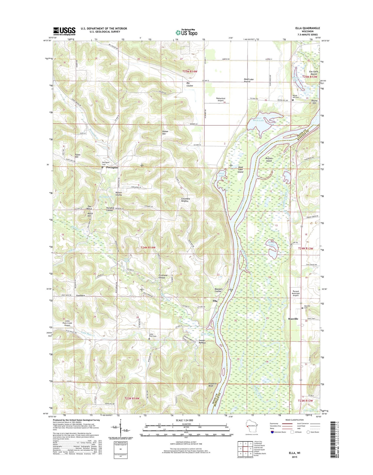
2022 topographic map quadrangle Ella in the state of Wisconsin. Scale: 1:24000. Based on the newly updated USGS 7.5' US Topo map series, this map is in the following counties: Pepin, Buffalo. The map contains contour data, water features, and other items you are used to seeing on USGS maps, but also has updated roads and other features. This is the next generation of topographic maps. Printed on high-quality waterproof paper with UV fade-resistant inks.
Quads adjacent to this one:
West: Nerike Hill
Northwest: Plum City
North: Arkansaw
Northeast: Durand North
East: Durand South
Southeast: Urne
South: Wabasha North
Southwest: Pepin
This map covers the same area as the classic USGS quad with code o44092e1.
Contains the following named places: 2 Reservoir, Bearpen Coulee, Big Coulee, Boyd Spring, Buffalo Island, Columbia Heights, Dead Lake, Dead Lake Island, Dead Lake Prairie, Durand Municipal Airport, Eau Galle Mound, Elk Creek, Ella, Frickland Coulee, Ganoe Hill, Gates Hill, Goatback, Kallstrom Mercer Group Dam, Little Buffalo Slough, Little Plum Cemetery, Little Plum Church, Little Plum Creek, Little Plum Creek Airport, Little Plum School, Lower Spring Creek School, Marble School, Maxville, Maxville Cemetery, Maxville Prairie, Maxville Prairie School, Notch Hill, Oak Center School, Paradise Coulee, Patten Coulee, Pepin Hill Church, Plum Creek, Plum Creek 12 E-4499 Dam, Plummer School, Porcupine, Porcupine Cemetery, Porcupine Creek, Round Hill, Round Hill Cemetery, Rutherford Airport, Savoy, Silver Birch Lake, Silver Birch Park, Spring Creek, Stump Lake, Sunnybrook School, Swede Ramble, The Notch, Town of Frankfort, West Frankfort School, Wilcox Lake