MyTopo
Pioneer Lake Wisconsin US Topo Map
Couldn't load pickup availability
Also explore the Pioneer Lake Forest Service Topo of this same quad for updated USFS data
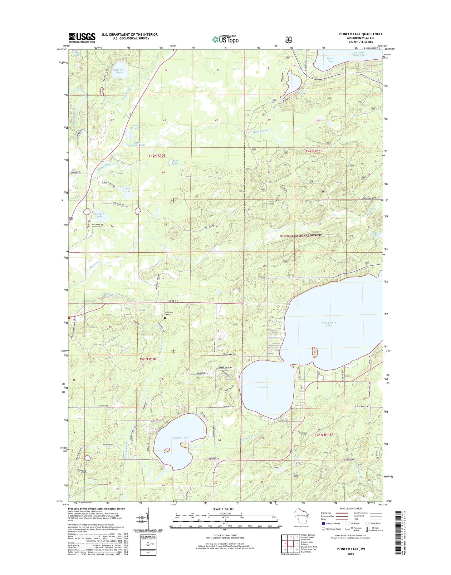
2022 topographic map quadrangle Pioneer Lake in the state of Wisconsin. Scale: 1:24000. Based on the newly updated USGS 7.5' US Topo map series, this map is in the following counties: Vilas. The map contains contour data, water features, and other items you are used to seeing on USGS maps, but also has updated roads and other features. This is the next generation of topographic maps. Printed on high-quality waterproof paper with UV fade-resistant inks.
Quads adjacent to this one:
West: Stormy Lake
Northwest: Black Oak Lake
North: Land O' Lakes
Northeast: Imp Lake
East: Phelps
Southeast: Anvil Lake
South: Eagle River East
Southwest: Eagle River West
This map covers the same area as the classic USGS quad with code o46089a2.
Contains the following named places: Augustus Adolphus Church, Conover Volunteer Fire Department, Denton Lake, Hildegard Cemetery, Kildare Lake, Lac des Fleurs, Lac Vieux Desert 1907C335 Dam, Lake Pleasant, Lawler Lake, Little Donahue Lake, North Twin Lake, Outlet Bay, Pioneer Lake, Portage Creek, South Lakes Church, Twin Lake Church, Twin Lakes, Twin Lakes 2WP264 Dam, Twin River, Wolf Lake