MyTopo
Pleasantville Wisconsin US Topo Map
Couldn't load pickup availability
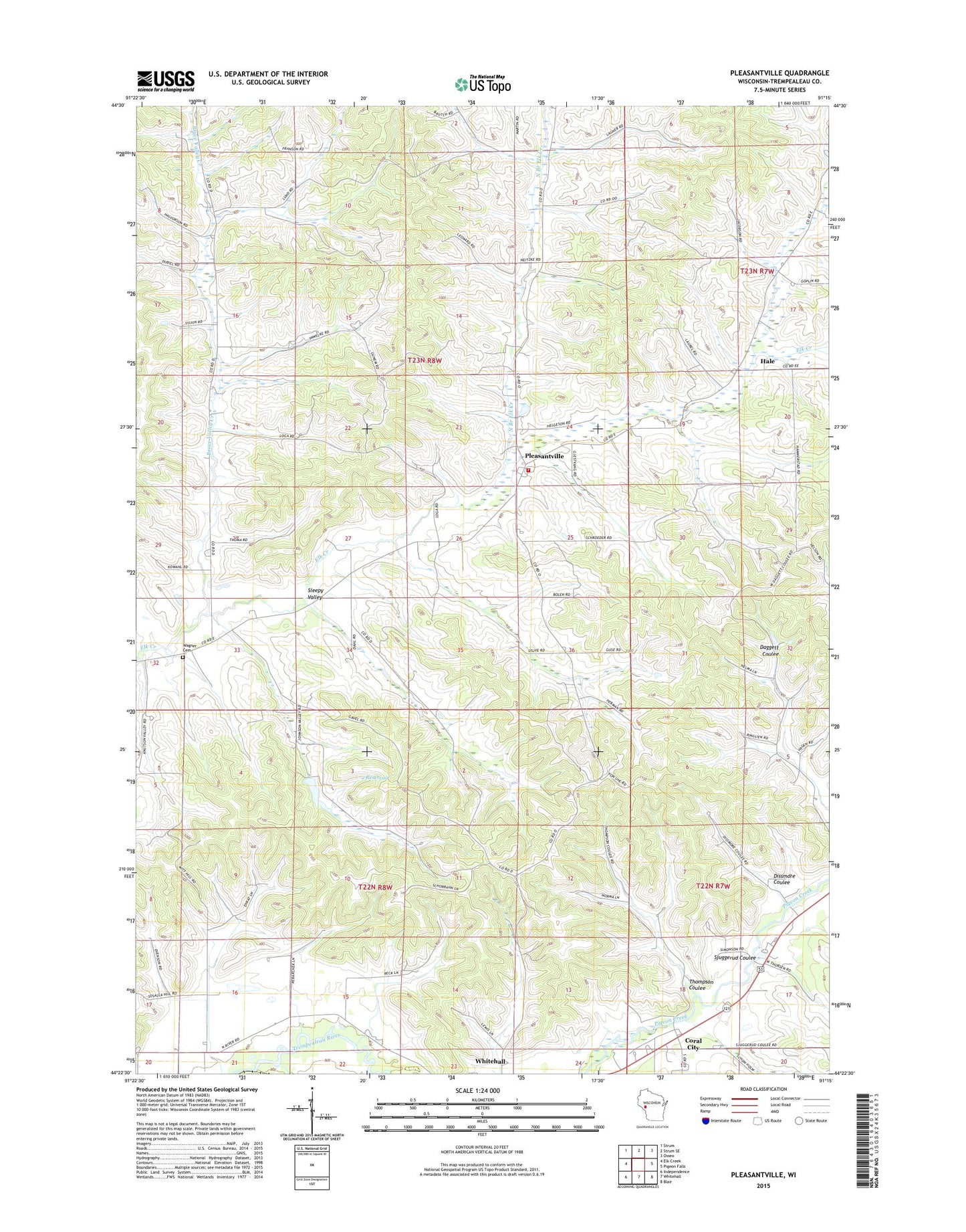
2022 topographic map quadrangle Pleasantville in the state of Wisconsin. Scale: 1:24000. Based on the newly updated USGS 7.5' US Topo map series, this map is in the following counties: Trempealeau. The map contains contour data, water features, and other items you are used to seeing on USGS maps, but also has updated roads and other features. This is the next generation of topographic maps. Printed on high-quality waterproof paper with UV fade-resistant inks.
Quads adjacent to this one:
West: Elk Creek
Northwest: Strum
North: Strum SE
Northeast: Osseo
East: Pigeon Falls
Southeast: Blair
South: Whitehall
Southwest: Independence
This map covers the same area as the classic USGS quad with code o44091d3.
Contains the following named places: 2 Reservoir, 54773, Bruce Valley Church, Bruce Valley Creek, Bruce Valley School, Caswell School, Coral City, Coral City School, Dissmore Coulee, Elk Creek Lutheran Church, Hale, Hale Township Volunteer Fire Department, North Branch Elk Creek, North Branch School, Pike School, Pleasantville, Pleasantville School, Saint Johns Church, Sjuggerud Coulee, Sleepy Valley, Thompson Coulee, Town of Hale, Town of Lincoln, Wagner Cemetery, Wagner School, Whitehall Pigeon Rod Gun Club G7439 Dam, WHTL-FM (Whitehall)