MyTopo
Elk Creek Wisconsin US Topo Map
Couldn't load pickup availability
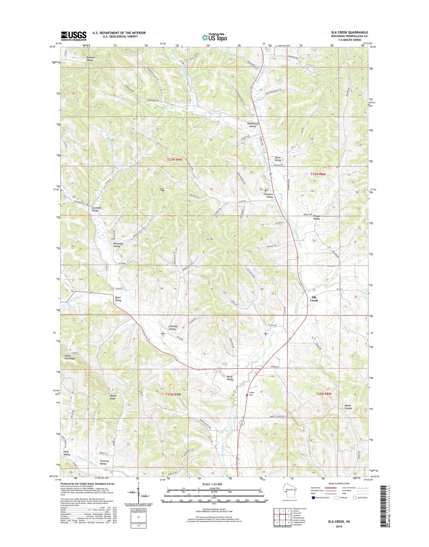
2022 topographic map quadrangle Elk Creek in the state of Wisconsin. Scale: 1:24000. Based on the newly updated USGS 7.5' US Topo map series, this map is in the following counties: Trempealeau. The map contains contour data, water features, and other items you are used to seeing on USGS maps, but also has updated roads and other features. This is the next generation of topographic maps. Printed on high-quality waterproof paper with UV fade-resistant inks.
Quads adjacent to this one:
West: Lookout
Northwest: Rossman Creek
North: Strum
Northeast: Strum SE
East: Pleasantville
Southeast: Whitehall
South: Independence
Southwest: Swinns Valley
This map covers the same area as the classic USGS quad with code o44091d4.
Contains the following named places: Borst Valley, Borst Valley Creek, Borst Valley School, Brick School, Chimney Rock, Chimney Rock Creek, Chimney Rock State Public Hunting Grounds, Cripps Cemetery, Cripps School, Elk Creek, Elk Creek School, Farmers School, Hawkenson School, Hawkinson Creek, Hawkinson Valley, Hunt Valley, Insteness School, Insteness Valley, Johnson Valley, Kwuosek Valley, Little Elk Creek, Maule Coulee School, Olson Valley, Roskos School, Roskos Valley, Russell, Russell School, Skagstad School, Sport Valley, Sport Valley Creek, Sunshine Valley, Town of Burnside, Town of Chimney Rock, Veum School, Walek Knob