MyTopo
Plum City Wisconsin US Topo Map
Couldn't load pickup availability
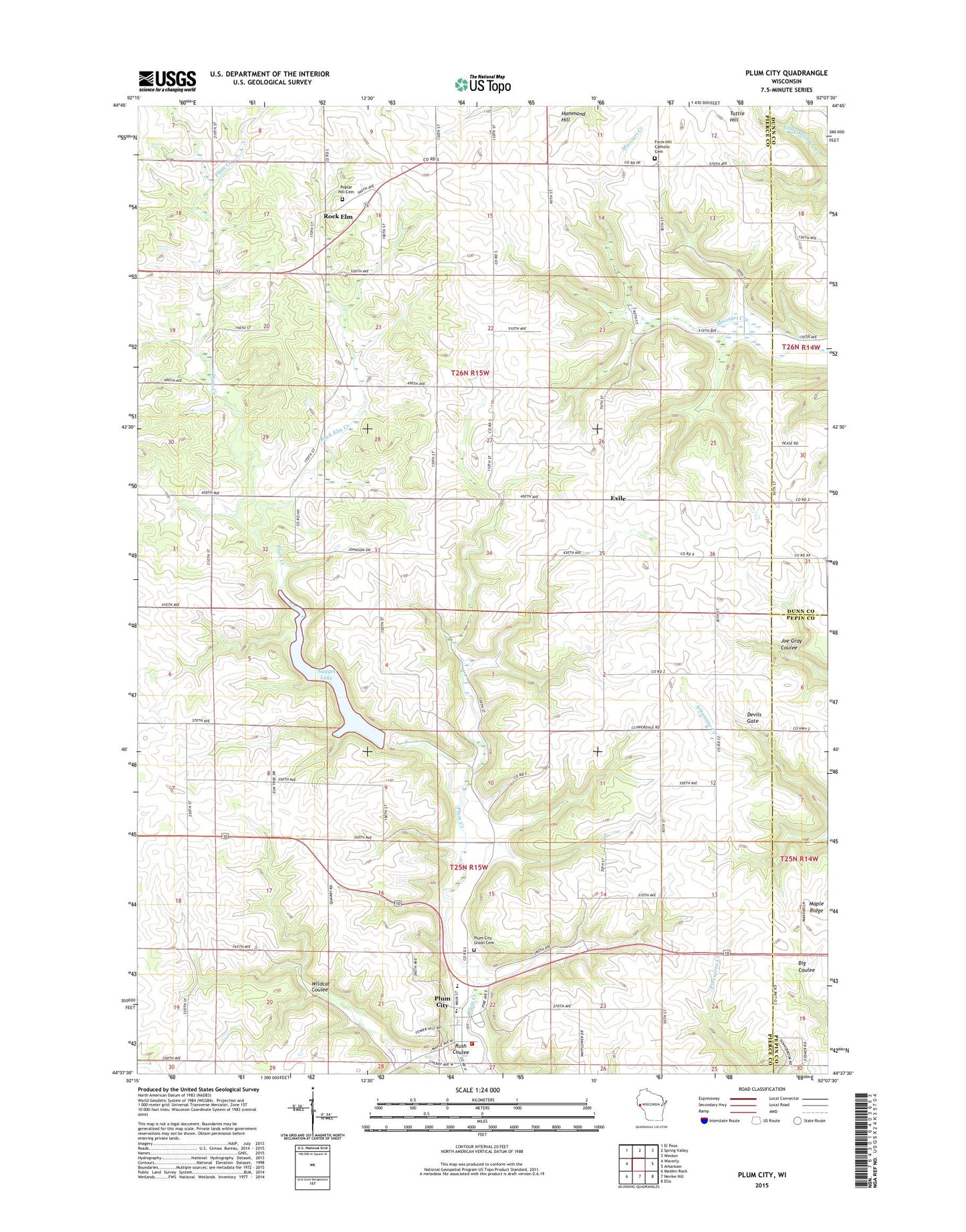
2018 topographic map quadrangle Plum City in the state of Wisconsin. Scale: 1:24000. Based on the newly updated USGS 7.5' US Topo map series, this map is in the following counties: Pierce, Dunn, Pepin. The map contains contour data, water features, and other items you are used to seeing on USGS maps, but also has updated roads and other features. This is the next generation of topographic maps. Printed on high-quality waterproof paper with UV fade-resistant inks.
Quads adjacent to this one:
West: Waverly
Northwest: El Paso
North: Spring Valley
Northeast: Weston
East: Arkansaw
Southeast: Ella
South: Nerike Hill
Southwest: Maiden Rock
Contains the following named places: 0.46 Reservoir, 2 Reservoir, Clipperdale School, Corner View School, Exile, Farm Hill, Farm Hill Catholic Cemetery, Gilles G 9016 Dam, Gilles School, Maiden Rock - Plum City - Stockholm Emergency Medical Services, Nugget Lake, Nugget Lake 18, Plum City, Plum City - Union Fire Department, Plum City Elementary School, Plum City High School, Plum City Post Office, Plum City Trailer Court, Plum City Union Cemetery, Plum Creek 2 E4499 Dam, Plum Creek 3 E4499 Dam, Plum Creek Woods State Natural Area, Poplar Grove School, Poplar Hill Cemetery, Rock Elm, Rock Elm Creek, Rush Coulee, Town of Rock Elm, Town of Union, Tripple Hill School, Union School, Village of Plum City, Wildcat Coulee