MyTopo
Arkansaw Wisconsin US Topo Map
Couldn't load pickup availability
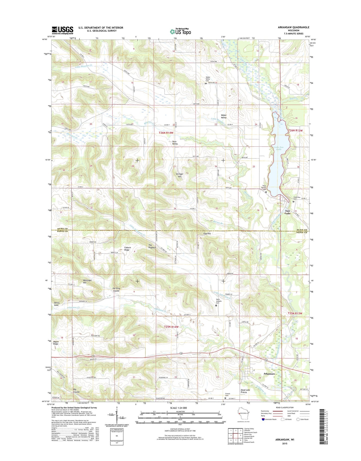
2022 topographic map quadrangle Arkansaw in the state of Wisconsin. Scale: 1:24000. Based on the newly updated USGS 7.5' US Topo map series, this map is in the following counties: Dunn, Pepin. The map contains contour data, water features, and other items you are used to seeing on USGS maps, but also has updated roads and other features. This is the next generation of topographic maps. Printed on high-quality waterproof paper with UV fade-resistant inks.
Quads adjacent to this one:
West: Plum City
Northwest: Spring Valley
North: Weston
Northeast: Menomonie South
East: Durand North
Southeast: Durand South
South: Ella
Southwest: Nerike Hill
This map covers the same area as the classic USGS quad with code o44092f1.
Contains the following named places: Arkansaw, Arkansaw Census Designated Place, Arkansaw Creek, Arkansaw Elementary School, Arkansaw Memorial Cemetery, Arkansaw Post Office, Barnes Branch, Big Arkansaw School, Big Coulee School, Chase Hill School, Clearview Cemetery, Coburn Ridge, Devils Gate, Eau Galle, Eau Galle Post Office, Eau Galle WP 193 Dam, Forestvale School, French Cemetery, Gap Hill, Hay Creek, Joe Gray Coulee, Knight School, Lake Eau Galle, Lake Eau Galle 173, Little Arkansaw Creek, Little Arkansaw School, Little Missouri Creek, Maple Ridge, Maple Ridge School, Missouri Creek, Missouri Valley School, Pine View Park, Point School, Saint Henrys Cemetery, Saint Josephs Cemetery, Saint Josephs Church, Stringer Hill, The Hogback, Town of Eau Galle, Town of Waterville, Twin Valley, Webber Valley School, Weber Valley, Weber Valley Cemetery, Weisinger Hill, Welch Point, ZIP Code: 54721