MyTopo
Weston Wisconsin US Topo Map
Couldn't load pickup availability
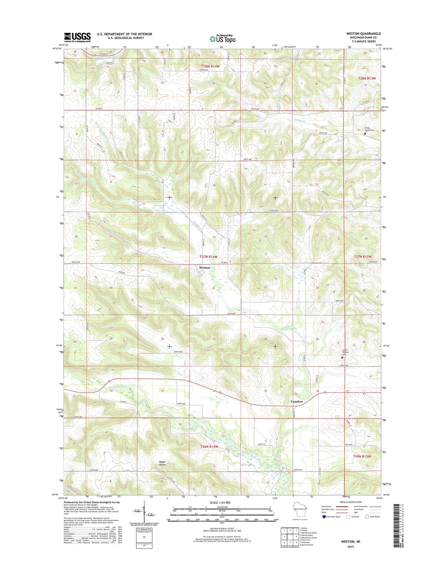
2022 topographic map quadrangle Weston in the state of Wisconsin. Scale: 1:24000. Based on the newly updated USGS 7.5' US Topo map series, this map is in the following counties: Dunn. The map contains contour data, water features, and other items you are used to seeing on USGS maps, but also has updated roads and other features. This is the next generation of topographic maps. Printed on high-quality waterproof paper with UV fade-resistant inks.
Quads adjacent to this one:
West: Spring Valley
Northwest: Wilson
North: Knapp
Northeast: Menomonie North
East: Menomonie South
Southeast: Durand North
South: Arkansaw
Southwest: Plum City
This map covers the same area as the classic USGS quad with code o44092g1.
Contains the following named places: 0.60 Reservoir, 3.0 Reservoir, 3.00 Reservoir, Birthman School, Comfort, Connell's Sunridge Orchard, Dunkard Church, Eau Galle River State Public Hunting Grounds, Fairview School, Highland School, Howison School, Irvine Creek Cemetery, Knights Creek, Knights Creek 1 E4242 Dam, Knights Creek 4 E4242 Dam, Knights Creek 5 E4242 Dam, Lower Weston Cemetery, Lower Weston Church, Morton Hill School, Nippersink School, North Branch Knights Creek, Palmer School, Starkey School, Town of Weston, West Branch Knights Creek, Weston