MyTopo
Porterfield Wisconsin US Topo Map
Couldn't load pickup availability
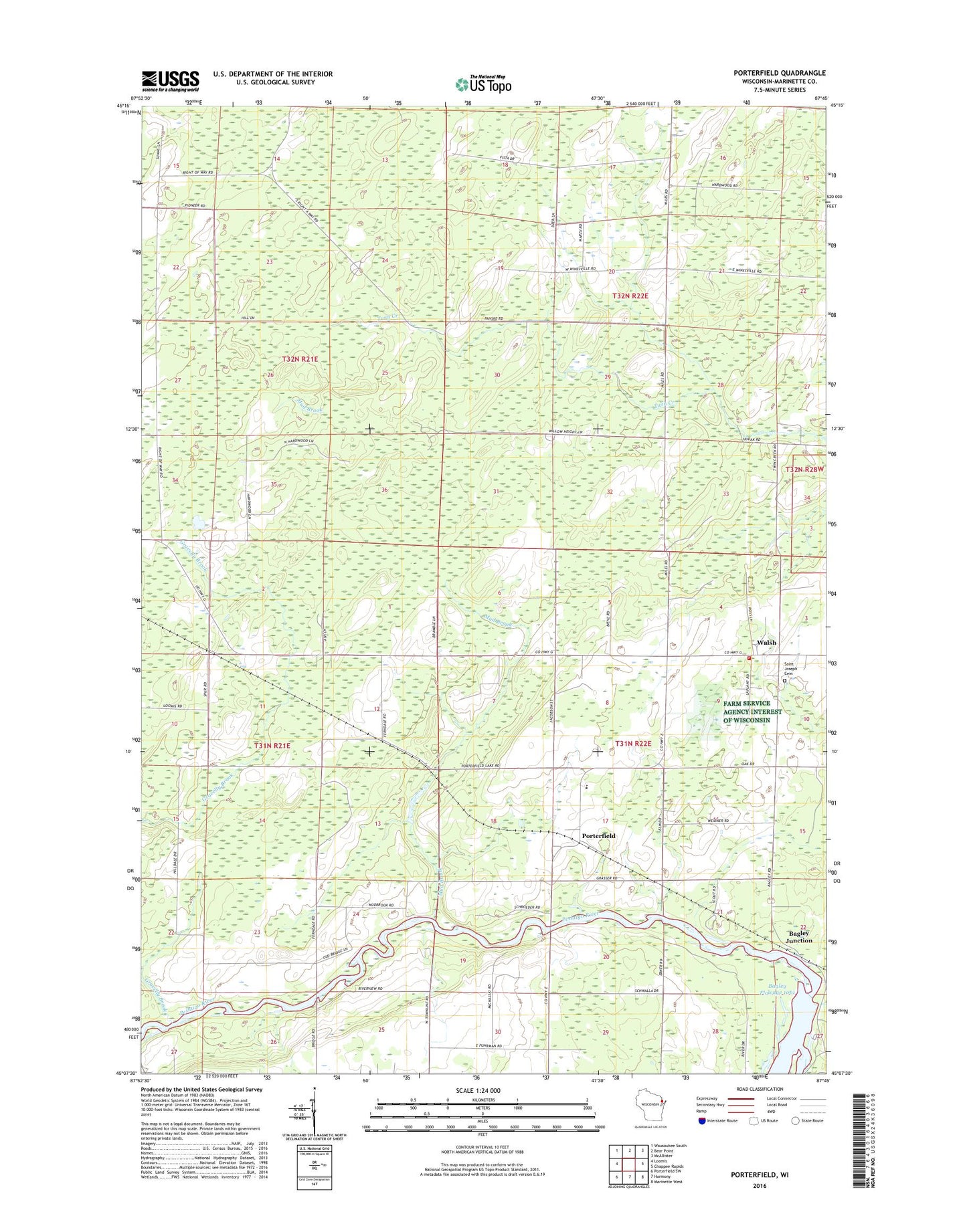
2018 topographic map quadrangle Porterfield in the state of Wisconsin. Scale: 1:24000. Based on the newly updated USGS 7.5' US Topo map series, this map is in the following counties: Marinette. The map contains contour data, water features, and other items you are used to seeing on USGS maps, but also has updated roads and other features. This is the next generation of topographic maps. Printed on high-quality waterproof paper with UV fade-resistant inks.
Quads adjacent to this one:
West: Loomis
Northwest: Wausaukee South
North: Bear Point
Northeast: McAllister
East: Chappee Rapids
Southeast: Marinette West
South: Harmony
Southwest: Porterfield SW
Contains the following named places: Bagley Junction, Brown Memorial Camp, Dickie School, Fairdale School, Fairmont School, Gravelly Brook, Grover - Porterfield Volunteer Fire Department, Miles School, Mud Brook, Phillips School, Porterfield, Porterfield Church, Porterfield Elementary School, Porterfield Post Office, Porterfield Quarry, Saint Joseph Cemetery, Saint Joseph Church, Town of Porterfield, Walsh, Wilson School, ZIP Code: 54159