MyTopo
Birchwood Wisconsin US Topo Map
Couldn't load pickup availability
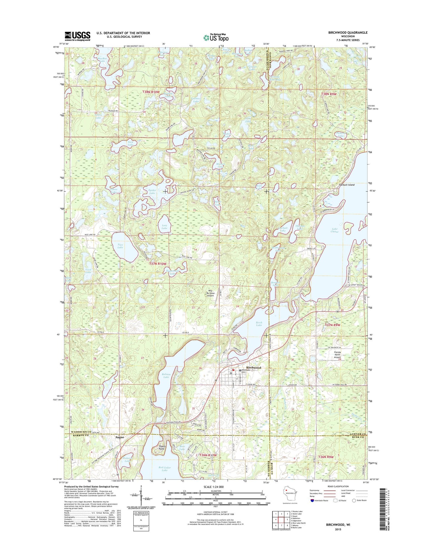
2022 topographic map quadrangle Birchwood in the state of Wisconsin. Scale: 1:24000. Based on the newly updated USGS 7.5' US Topo map series, this map is in the following counties: Washburn, Sawyer, Barron, Rusk. The map contains contour data, water features, and other items you are used to seeing on USGS maps, but also has updated roads and other features. This is the next generation of topographic maps. Printed on high-quality waterproof paper with UV fade-resistant inks.
Quads adjacent to this one:
West: Nobleton
Northwest: Potato Lake
North: Stone Lake
Northeast: Hauer
East: Edgewater
Southeast: Bucks Lake
South: Mikana
Southwest: Rice Lake North
This map covers the same area as the classic USGS quad with code o45091f5.
Contains the following named places: Angus, Angus Substation, Balsam Lake, Bass Lake, Beartrap Lake, Bennett Lake, Birch Lake, Birch Lake Dam, Birchwood, Birchwood Blue Hills Charter School, Birchwood Elementary School, Birchwood High School, Birchwood Middle School, Birchwood Police Department, Birchwood Post Office, Birchwood Sewage Disposal Plant, Birchwood Town Hall, Birchwood Village Hall, Birchwood Volunteer Fire Department, Birchwood Water Tower, Bodins Lake, Bridge Lake, County Line Lake, Doolittle County Park, Elbow Lake, Fawn Lake, Florida North Airport, Four Corners Ambulance Service, Garbutt Island, Garbutt Lake, Green Lake, Grutt Island, Lilac Time Airport, Log Museum, Loon Lake, Lost Lake, MacRae Lake, Matson Lake, McDermott Lake, Nice Lake, Nick Lake, Peters Lake, Peufald Lakes, Pickerel Lake, River Lake, Rock Lake, Saint John's Catholic Church, Sams Lake, Spider Lake, Spute Lake, Stouts Point, Sugarbush Lake, Superior Lake, Telstar Lake, Thomas Lake, Town of Birchwood, Trinity Luthern Church, United Methodist Church, Village of Birchwood, Vollmers Lake, Will-Be-Gone Airport, Woodlawn Cemetery, ZIP Code: 54817