MyTopo
Range Wisconsin US Topo Map
Couldn't load pickup availability
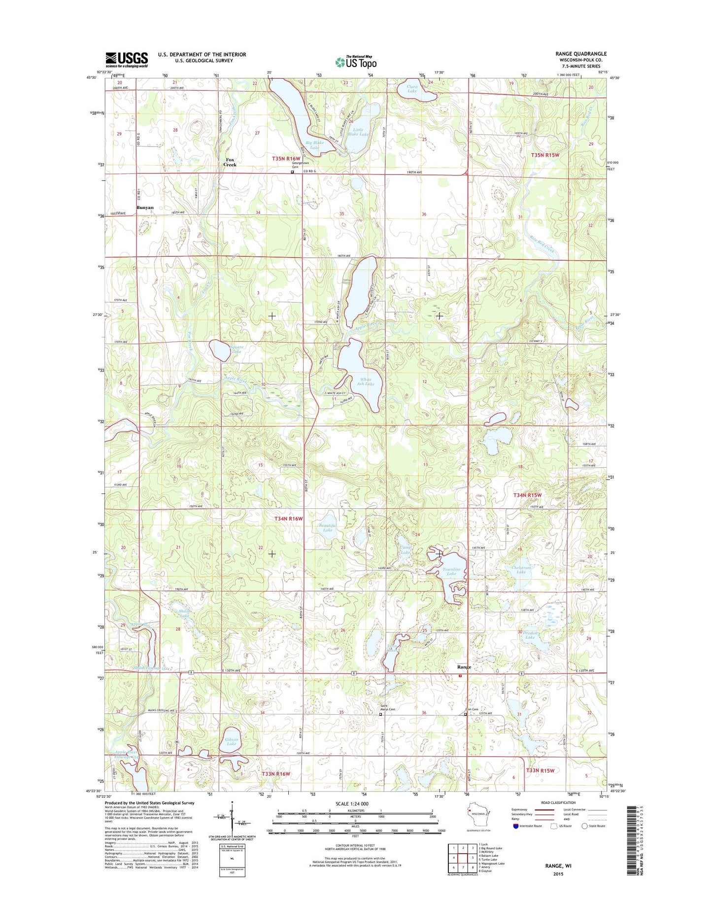
2022 topographic map quadrangle Range in the state of Wisconsin. Scale: 1:24000. Based on the newly updated USGS 7.5' US Topo map series, this map is in the following counties: Polk. The map contains contour data, water features, and other items you are used to seeing on USGS maps, but also has updated roads and other features. This is the next generation of topographic maps. Printed on high-quality waterproof paper with UV fade-resistant inks.
Quads adjacent to this one:
West: Balsam Lake
Northwest: Luck
North: Big Round Lake
Northeast: McKinley
East: Turtle Lake
Southeast: Clayton
South: Amery
Southwest: Wapogasset Lake
This map covers the same area as the classic USGS quad with code o45092d3.
Contains the following named places: Apple River Townhall, Apple River Township Fire Department, Apple River Valley School, Beautiful Lake, Big Blake Lake, Blake School, Bunyan, Camp Lake, Chelstrom Lake, Clara Lake, Deedon Lake, Deedon Lake Natural Orchard, Elim Cemetery, Elim Church, Fox Creek, Georgetown Cemetery, Georgetown Church, Georgetown Townhall, Gibson Lake, Happy Hollow School, Holy Rosary Church, Little Blake Lake, Markee Creek, Range, Rice Bed Creek, Rice Bed Creek State Wildlife Area, Ridler Dam, Saint Marys Cemetery, Saint Marys Church, School Number 1, Shiloh Flowage 151, Shiloh Lake, Square Lake, Town of Apple River, Townline Lake, Twin Lakes, White Ash Lake, ZIP Code: 54810