MyTopo
Readstown Wisconsin US Topo Map
Couldn't load pickup availability
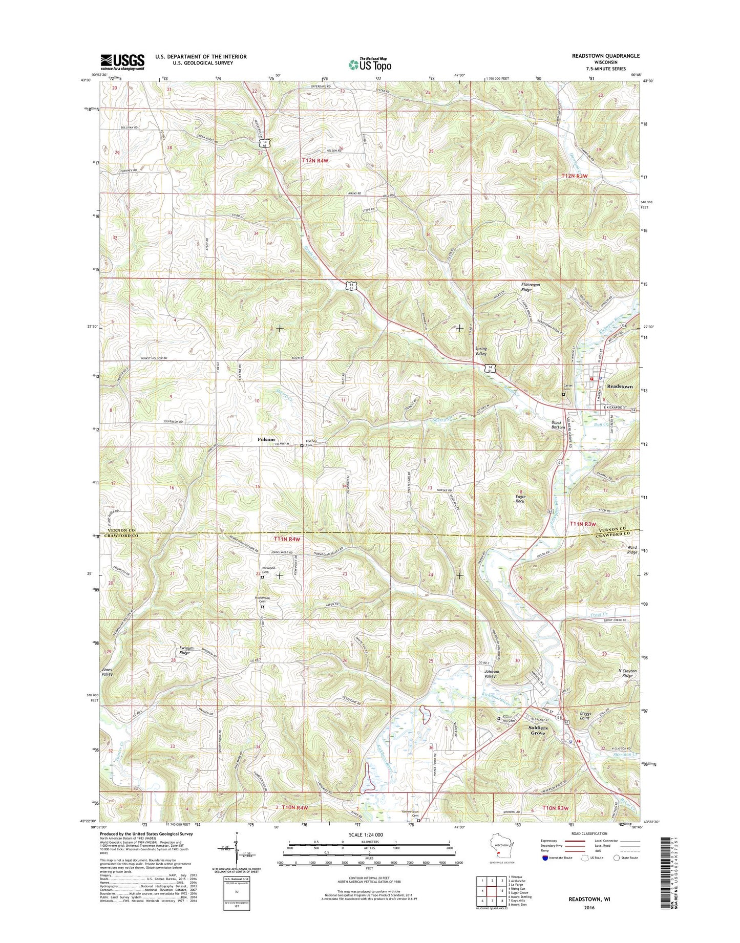
2022 topographic map quadrangle Readstown in the state of Wisconsin. Scale: 1:24000. Based on the newly updated USGS 7.5' US Topo map series, this map is in the following counties: Vernon, Crawford. The map contains contour data, water features, and other items you are used to seeing on USGS maps, but also has updated roads and other features. This is the next generation of topographic maps. Printed on high-quality waterproof paper with UV fade-resistant inks.
Quads adjacent to this one:
West: Rising Sun
Northwest: Viroqua
North: Avalanche
Northeast: La Farge
East: Sugar Grove
Southeast: Mount Zion
South: Gays Mills
Southwest: Mount Sterling
This map covers the same area as the classic USGS quad with code o43090d7.
Contains the following named places: Baker Creek, Black Bottom, Briggs Point, Carter Cemetery, Davisdale School, Day Creek, Eagle Rock, Ellefson Brothers Quarry, Flannagan Ridge, Folsom, Forest Hill Cemetery, Fortney Cemetery, Franklin Church, Hinkst School, Hooverson Cemetery, Janes Creek, Johnson Valley, Jones Valley, Kickapoo Church, Lyster School, North Crawford High School, North Crawford Rescue Squad, Pine Knob, Pine Knob Church, Pine Knob School, Reads Creek, Readstown, Readstown Elementary School, Readstown Emergency Medical Services, Readstown Police Department, Readstown Post Office, Readstown Volunteer Fire Department, Sheridan Creek, Sherry Creek, Sherry School, Soldiers Grove, Soldiers Grove Fire Department, Soldiers Grove Police Department, South Kickapoo Cemetery, Spring Valley, Spring Valley School, Swigum Ridge, Trout Creek, Village of Readstown, Village of Soldiers Grove, Yankeetown, Yankeetown Cemetery, Yankeetown School, ZIP Code: 54652