MyTopo
Regina Wisconsin US Topo Map
Couldn't load pickup availability
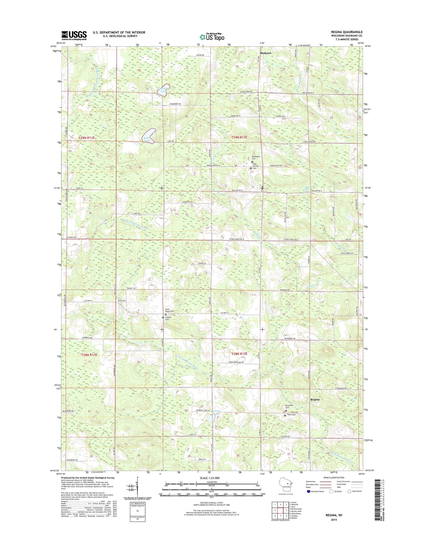
2022 topographic map quadrangle Regina in the state of Wisconsin. Scale: 1:24000. Based on the newly updated USGS 7.5' US Topo map series, this map is in the following counties: Shawano. The map contains contour data, water features, and other items you are used to seeing on USGS maps, but also has updated roads and other features. This is the next generation of topographic maps. Printed on high-quality waterproof paper with UV fade-resistant inks.
Quads adjacent to this one:
West: Birnamwood
Northwest: Aniwa
North: Mattoon
Northeast: Zoar
East: Burney Lake
Southeast: Bowler
South: Shepley
Southwest: Wittenberg
This map covers the same area as the classic USGS quad with code o44089h1.
Contains the following named places: Almon Town Cemetery, Baker Lake, Camp Chin-Be-Gota, Cranberry Lake, Hennig Lake, Holy Family Cemetery, Kolpack Lookout Tower, Kolpack School, Leiskau Cemetery, Leiskau School, Nazarene Church, Regina, Regina School, Saint Pauls Cemetery, Saint Pauls Riverside Cemetery, Saint Paulus Church, Scandinavian Church, Schroeder G770 Dam, Sportsman Lake, Town of Almon, Town of Hutchins, Woodlawn Cemetery