MyTopo
Burney Lake Wisconsin US Topo Map
Couldn't load pickup availability
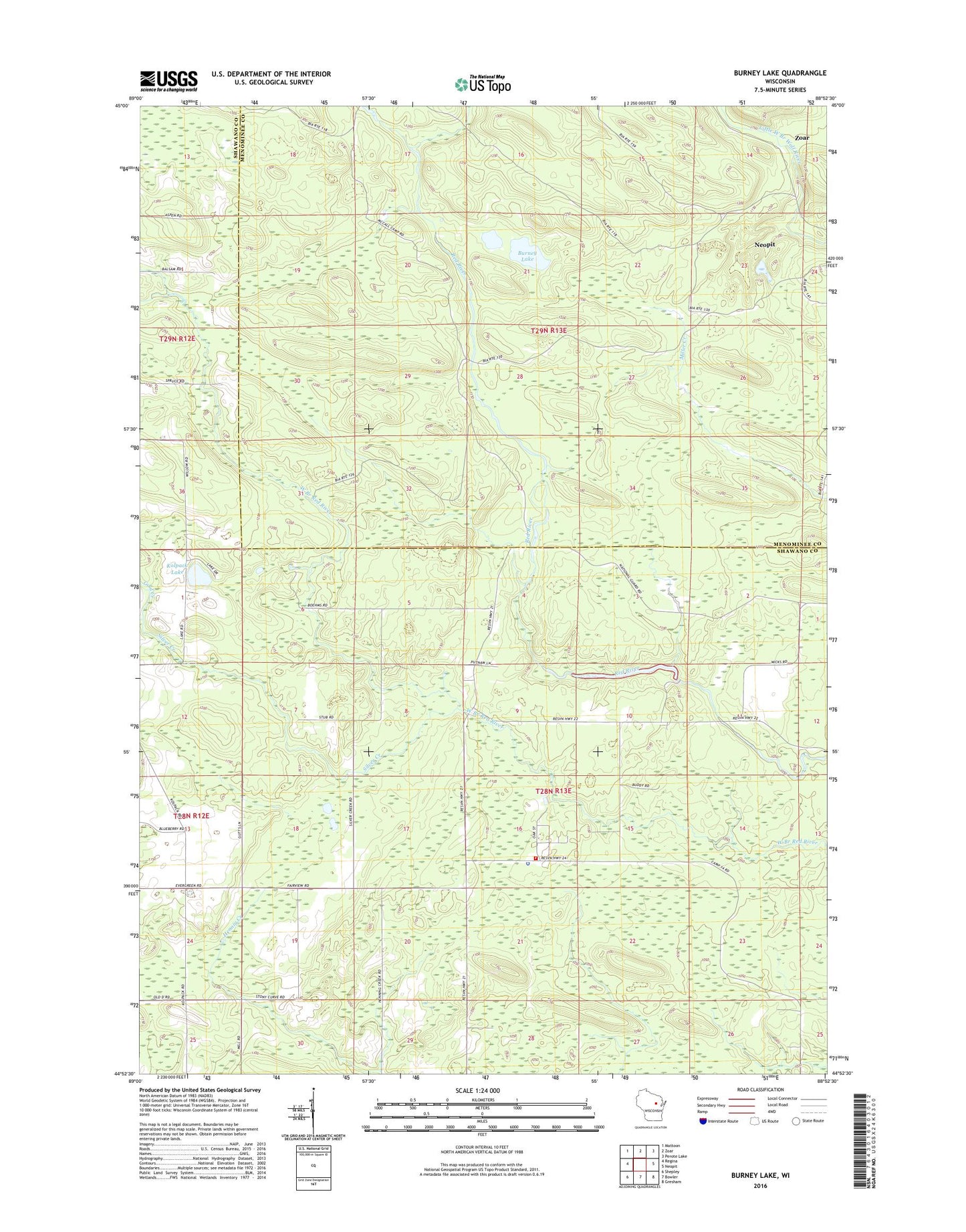
2022 topographic map quadrangle Burney Lake in the state of Wisconsin. Scale: 1:24000. Based on the newly updated USGS 7.5' US Topo map series, this map is in the following counties: Shawano, Menominee. The map contains contour data, water features, and other items you are used to seeing on USGS maps, but also has updated roads and other features. This is the next generation of topographic maps. Printed on high-quality waterproof paper with UV fade-resistant inks.
Quads adjacent to this one:
West: Regina
Northwest: Mattoon
North: Zoar
Northeast: Perote Lake
East: Neopit
Southeast: Gresham
South: Bowler
Southwest: Shepley
This map covers the same area as the classic USGS quad with code o44088h8.
Contains the following named places: Almon, Burney Lake, Gold Creek, Hemlock Lake, Kolpack Lake, Silver Creek, Stockbridge - Munsee Community Mohican Nation Police Department, Stockbridge - Munsee Volunteer Fire Department, Stockbridge Munsee Community, Town of Bartelme, ZIP Code: 54416