MyTopo
Rio Wisconsin US Topo Map
Couldn't load pickup availability
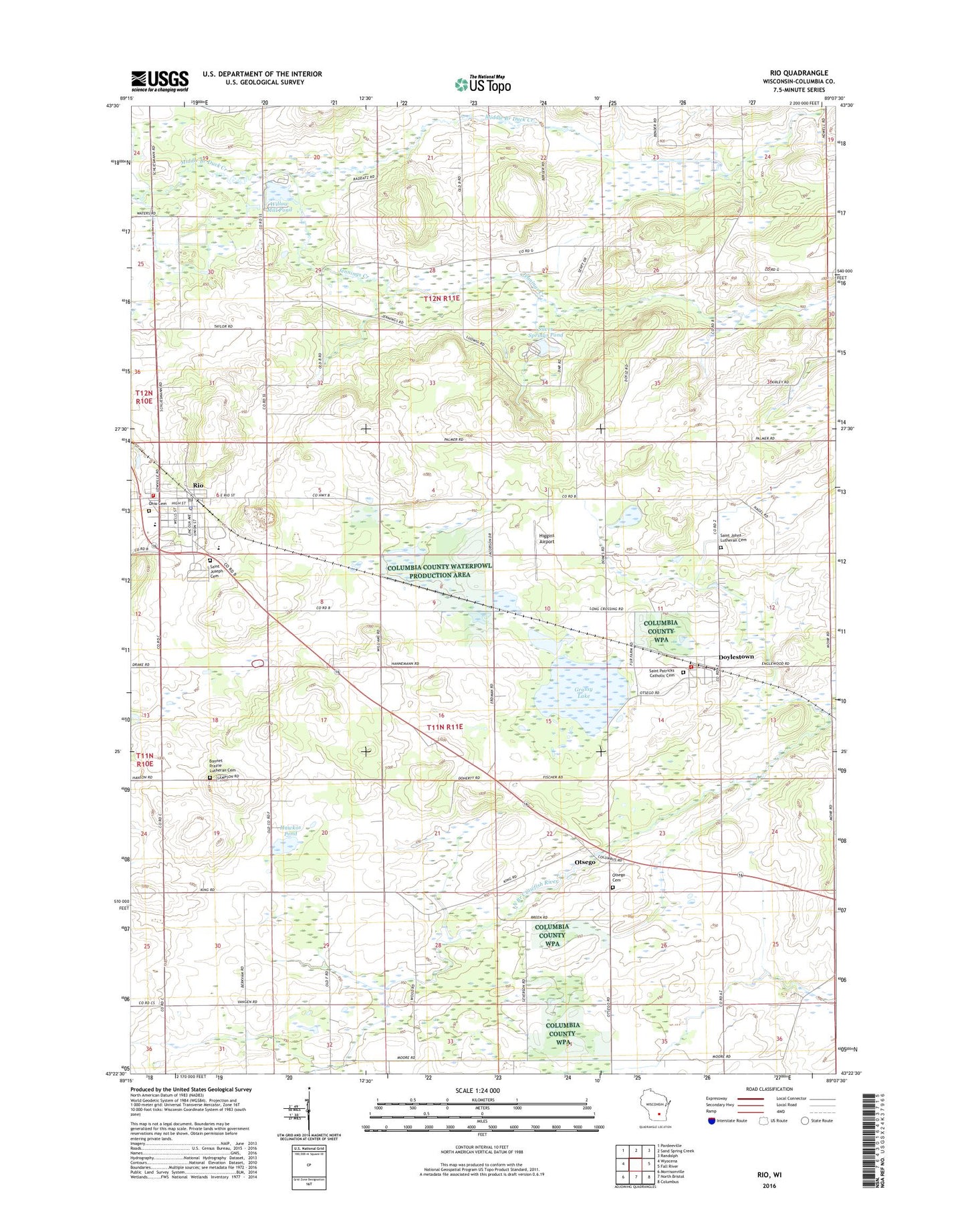
2018 topographic map quadrangle Rio in the state of Wisconsin. Scale: 1:24000. Based on the newly updated USGS 7.5' US Topo map series, this map is in the following counties: Columbia. The map contains contour data, water features, and other items you are used to seeing on USGS maps, but also has updated roads and other features. This is the next generation of topographic maps. Printed on high-quality waterproof paper with UV fade-resistant inks.
Quads adjacent to this one:
West: Wyocena
Northwest: Pardeeville
North: Sand Spring Creek
Northeast: Randolph
East: Fall River
Southeast: Columbus
South: North Bristol
Southwest: Morrisonville
Contains the following named places: 0.985 Reservoir, 53928, 53960, Assembly of God Church, Bonnet Prairie Cemetery, Bonnet Prairie Lutheran Church, Doylestown, Doylestown Post Office, Doylestown Volunteer Fire Department, Grassy Lake, Grassy Lake State Wildlife Area, Hawkos Pond, Higgins Airport, Ingram Mill 2WP1153 Dam, Jennings Creek, Jennings Creek State Wildlife Area, King Corner School, Monroe School, Ohio Cemetery, Otsego, Otsego Cemetery, Redeemer Lutheran Church, Rio, Rio Elementary School, Rio Fire Department, Rio Middle / High School, Rio Police Department, Rio Post Office, Saint Johns Lutheran Cemetery, Saint Joseph's Catholic Cemetery, Saint Josephs Catholic Church, Saint Patricks Catholic Cemetery, Schiller Dam, Silver Springs Pond, Town of Otsego, Village of Doylestown, Village of Rio, Willow Mill Pond