MyTopo
Pardeeville Wisconsin US Topo Map
Couldn't load pickup availability
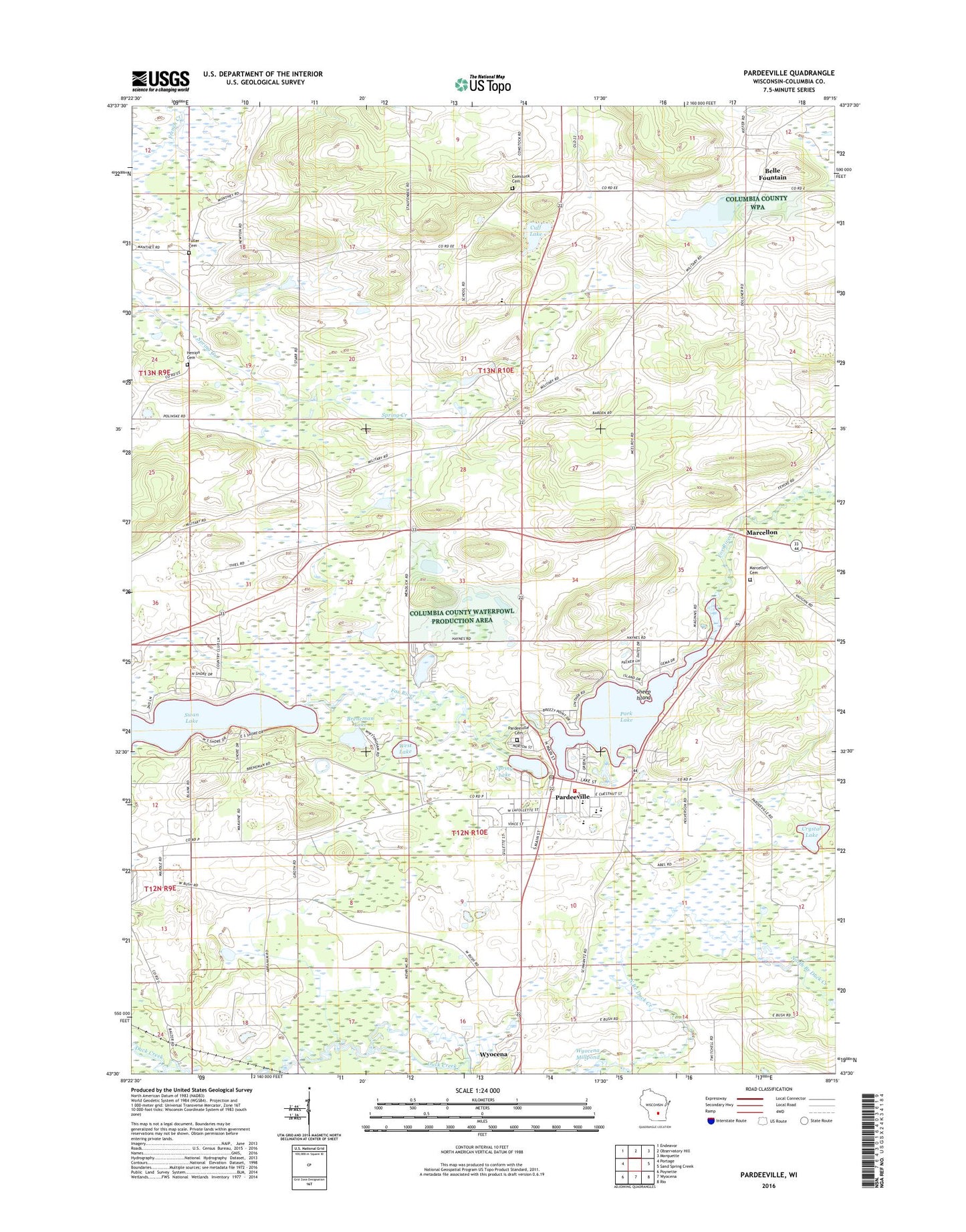
2022 topographic map quadrangle Pardeeville in the state of Wisconsin. Scale: 1:24000. Based on the newly updated USGS 7.5' US Topo map series, this map is in the following counties: Columbia. The map contains contour data, water features, and other items you are used to seeing on USGS maps, but also has updated roads and other features. This is the next generation of topographic maps. Printed on high-quality waterproof paper with UV fade-resistant inks.
Quads adjacent to this one:
West: Portage
Northwest: Endeavor
North: Observatory Hill
Northeast: Marquette
East: Sand Spring Creek
Southeast: Rio
South: Wyocena
Southwest: Poynette
This map covers the same area as the classic USGS quad with code o43089e3.
Contains the following named places: Angie Williams Cox Public Library, Becker Lake, Belle Fountain, Breneman Lake, Columbia County Sheriff Office - Pardeeville Substation, Comstock Cemetery, Crystal Lake, Cuff Lake, First Presbyterian Church, Free Methodist Church, Fuller Cemetery, Henion Cemetery, Marcellon, Marcellon Cemetery, Marcellon Elementary School, Pardeeville, Pardeeville 2WP832 Dam, Pardeeville Cemetery, Pardeeville District Ambulance Service, Pardeeville Elementary School, Pardeeville Fire Department, Pardeeville High School, Pardeeville Middle School, Pardeeville Police Department, Pardeeville Post Office, Pardeeville Wastewater Treatment Facility, Park Lake, Park Lake 56, Reuhl Landing Strip, Rohdes Airport, Saint Johns Evangelical Lutheran Church, Saint Johns Lutheran Church, Saint John's Lutheran School, Saint Marys Roman Catholic Church, Sheep Island, Spring Lake, Swan Lake, Town of Marcellon, Town of Wyocena, Valley View Farm, Village of Pardeeville, Wesleyan Bible Church, West Lake, Wildia Landing Strip, Williams Camp, Wyocena Wastewater Treatment Facility, ZIP Code: 53954