MyTopo
Wyocena Wisconsin US Topo Map
Couldn't load pickup availability
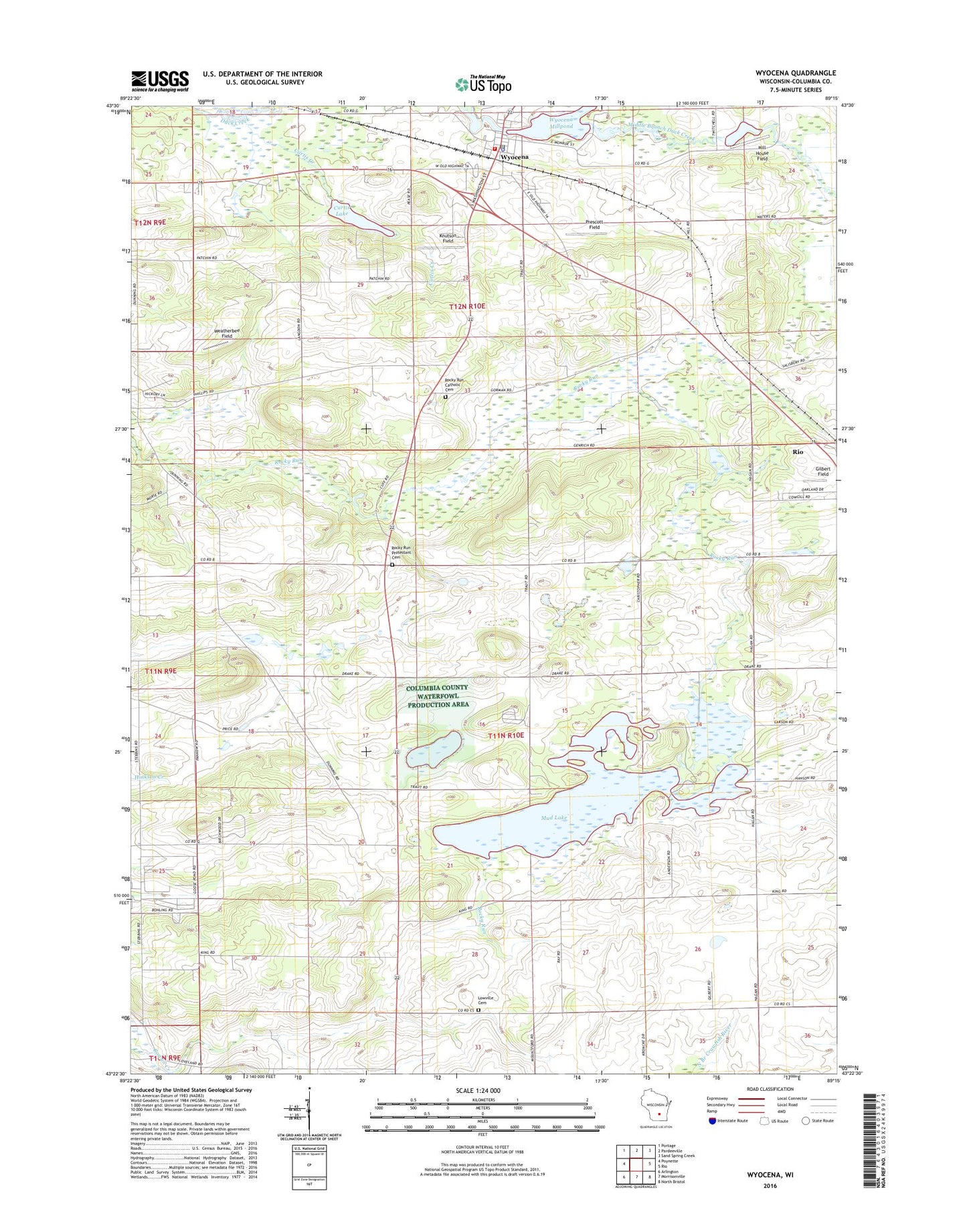
2022 topographic map quadrangle Wyocena in the state of Wisconsin. Scale: 1:24000. Based on the newly updated USGS 7.5' US Topo map series, this map is in the following counties: Columbia. The map contains contour data, water features, and other items you are used to seeing on USGS maps, but also has updated roads and other features. This is the next generation of topographic maps. Printed on high-quality waterproof paper with UV fade-resistant inks.
Quads adjacent to this one:
West: Poynette
Northwest: Portage
North: Pardeeville
Northeast: Sand Spring Creek
East: Rio
Southeast: North Bristol
South: Morrisonville
Southwest: Arlington
This map covers the same area as the classic USGS quad with code o43089d3.
Contains the following named places: 1.37 Reservoir, 37 Reservoir, 53969, Columbia County, Curtis 2WP1601 Dam, Curtis Creek, Curtis Lake, Curtis Landing Strip, Figor Dam, Gilbert Field, Knutson Field, Little Bluff Campground, Lowville, Lowville Cemetery, Lowville Center School, Middle Branch Duck Creek, Mill House Field, Mud Lake, Mud Lake State Public Hunting Grounds, North Branch Duck Creek, Poynette State Game Farm, Prescott Field, Rocky Run Catholic Cemetery, Rocky Run Oak Savanna State Natural Area, Rocky Run Protestant Cemetery, South Lowville School, Taff D2076 Dam, Town of Lowville, Village of Wyocena, Weatherbee Field, Wyocena, Wyocena Bureau of Fire, Wyocena Dam, Wyocena Police Department, Wyocena Post Office, Wyona County Park, Wyona Lake