MyTopo
Morrisonville Wisconsin US Topo Map
Couldn't load pickup availability
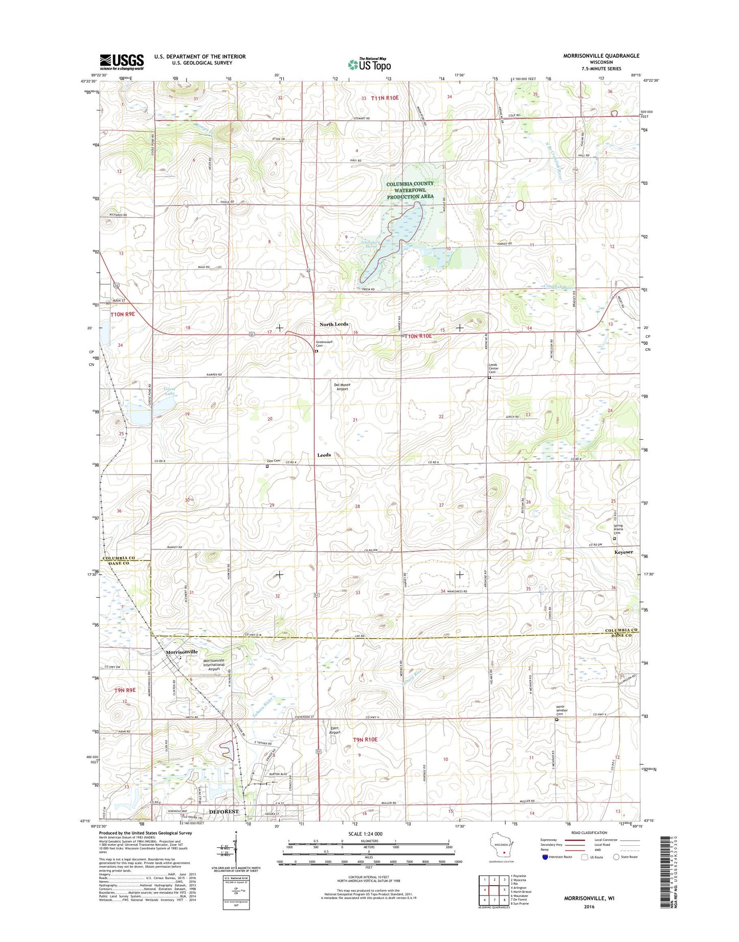
2022 topographic map quadrangle Morrisonville in the state of Wisconsin. Scale: 1:24000. Based on the newly updated USGS 7.5' US Topo map series, this map is in the following counties: Columbia, Dane. The map contains contour data, water features, and other items you are used to seeing on USGS maps, but also has updated roads and other features. This is the next generation of topographic maps. Printed on high-quality waterproof paper with UV fade-resistant inks.
Quads adjacent to this one:
West: Arlington
Northwest: Poynette
North: Wyocena
Northeast: Rio
East: North Bristol
Southeast: Sun Prairie
South: De Forest
Southwest: Waunakee
This map covers the same area as the classic USGS quad with code o43089c3.
Contains the following named places: Audubon Goose Pond State Natural Area, Dane County Sheriff's Office - Northeast Precinct, De Forest Area Community Center, Del Monte Airport, Elert Airport, Empire Prairie School, Goose Lake, Greenwood Cemetery, Happy Hour School, Keyeser, LaFollette School, Leeds, Leeds Center, Leeds Center Cemetery, Leeds Elementary School, Lord of Love Lutheran Church, Morrisonville, Morrisonville Elementary School, Morrisonville International Airport, Morrisonville Post Office, North Leeds, North Windsor Cemetery, North Windsor School, North Windsor United Methodist Church, Schoeneberg Marsh, Spring Prairie - Hauge Cemetery, Spring Prairie Lutheran Cemetery, Spring Prairie Lutheran Church, Sullivan Field, Town of Leeds, United in Christ Lutheran Cemetery, University of Wisconsin Experimental Farm, Village of Arlington, Wanger-In Airport, Zion Cemetery, ZIP Codes: 53532, 53571, 53911