MyTopo
Saint Cloud Wisconsin US Topo Map
Couldn't load pickup availability
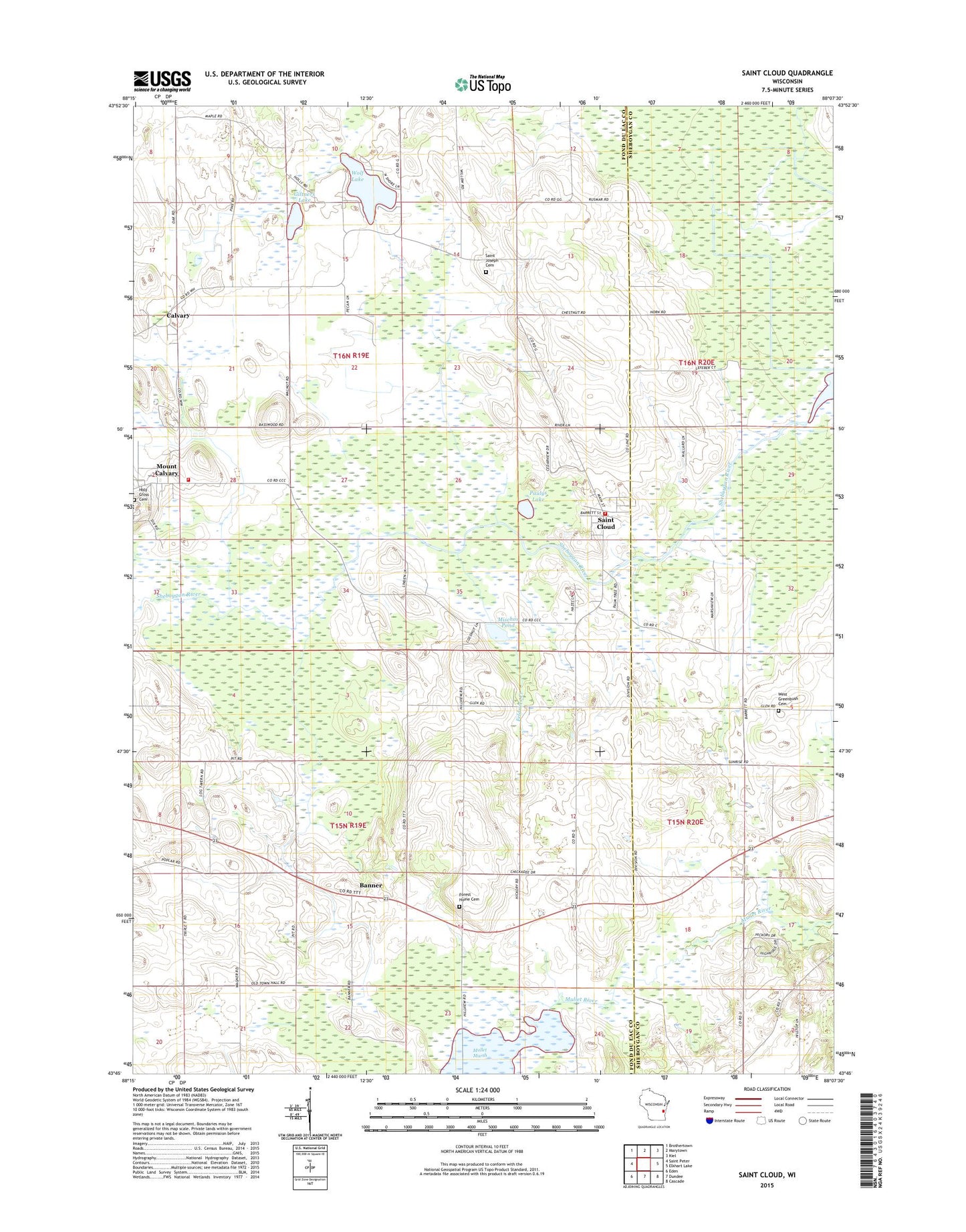
2022 topographic map quadrangle Saint Cloud in the state of Wisconsin. Scale: 1:24000. Based on the newly updated USGS 7.5' US Topo map series, this map is in the following counties: Fond du Lac, Sheboygan. The map contains contour data, water features, and other items you are used to seeing on USGS maps, but also has updated roads and other features. This is the next generation of topographic maps. Printed on high-quality waterproof paper with UV fade-resistant inks.
Quads adjacent to this one:
West: Saint Peter
Northwest: Brothertown
North: Marytown
Northeast: Kiel
East: Elkhart Lake
Southeast: Cascade
South: Dundee
Southwest: Eden
This map covers the same area as the classic USGS quad with code o43088g2.
Contains the following named places: Banner, Calvary, Elder Grove School, Feldners Creek, Forest Home Cemetery, Giltners Lake, Mischos Pond, Mount Calvary, Mount Calvary Fire Department / Mount Calvary Ambulance Service, Mount Calvary Post Office, Mullet Creek G12.473 Dam, Mullet Marsh, Mullet Marsh 15 Reservoir, Paulys Lake, Saint Cloud, Saint Cloud Post Office, Saint Cloud State Wildlife Areas, Saint Cloud Volunteer Fire Department, Saint Joseph Cemetery, Saint Joseph Church, Saint Joseph School, Saint Lawrence Seminary High School, Town of Forest, Town of Marshfield, Villa Loretto Rest Home, Village of Mount Calvary, Village of Saint Cloud, West Greenbush Cemetery, West Greenbush Church, Wolf Lake, Wolf Lake Park, ZIP Codes: 53057, 53079