MyTopo
Sarona Wisconsin US Topo Map
Couldn't load pickup availability
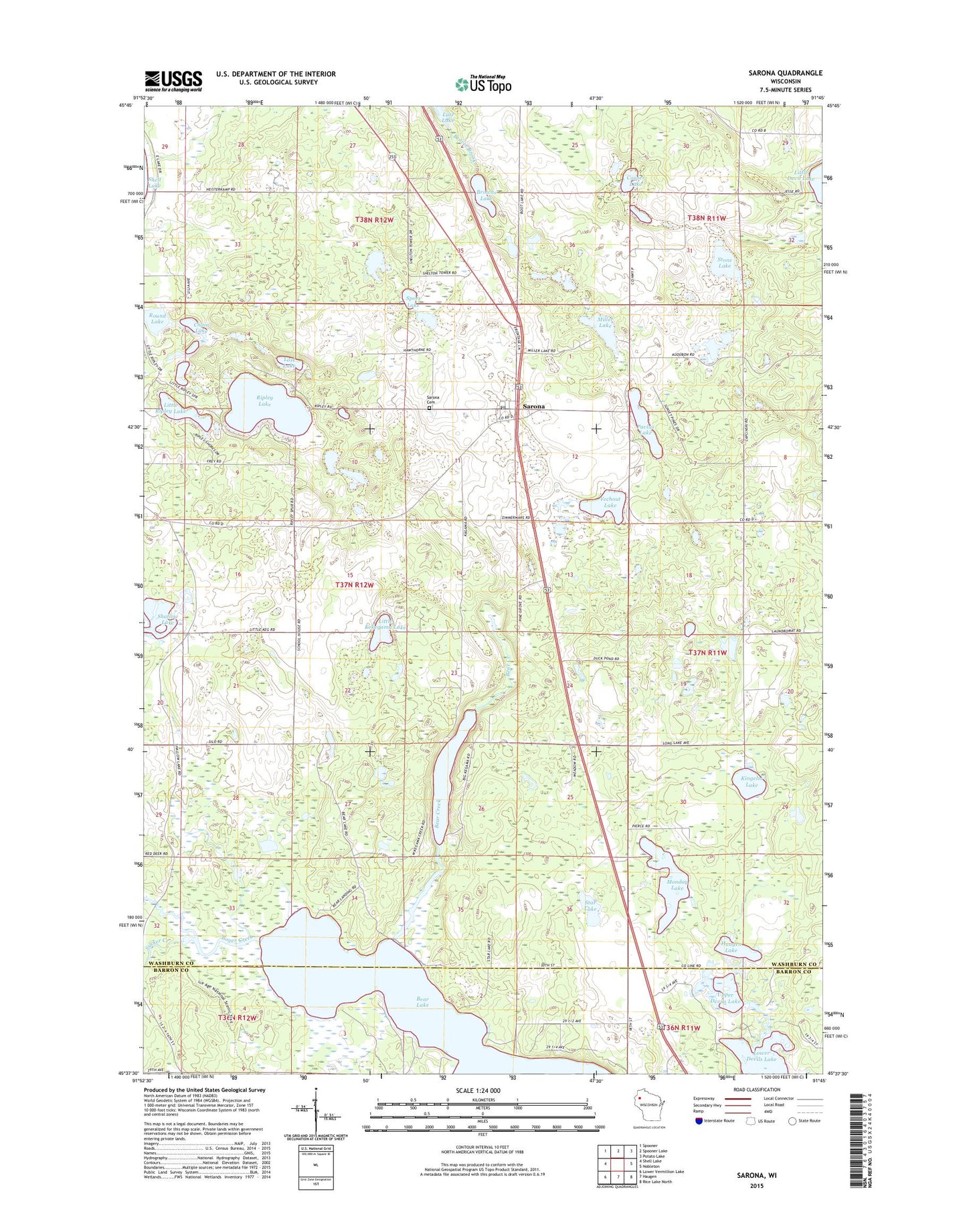
2018 topographic map quadrangle Sarona in the state of Wisconsin. Scale: 1:24000. Based on the newly updated USGS 7.5' US Topo map series, this map is in the following counties: Washburn, Barron. The map contains contour data, water features, and other items you are used to seeing on USGS maps, but also has updated roads and other features. This is the next generation of topographic maps. Printed on high-quality waterproof paper with UV fade-resistant inks.
Quads adjacent to this one:
West: Shell Lake
Northwest: Spooner
North: Spooner Lake
Northeast: Potato Lake
East: Nobleton
Southeast: Rice Lake North
South: Haugen
Southwest: Lower Vermillion Lake
Contains the following named places: American Tower Site 5057, Bear Creek, Bear Lake, Bear Lake State Public Fishery Area, Boyer Creek, Browns Lake, Casper Lake, Chain Lake, Four Seasons Airport, Haugen Lake, Kekegama Lake, Kingelm Lake, Little Kekegama Lake, Little Ripley Lake, Lost Lake, Lower Devils Lake, Microwave Tower American Tower Site 50574, Miller Lake, Monday Lake, Pavlas Lake, Ripley Lake, Round Lake, Sarona, Sarona Cemetery, Sarona Post Office, Sarona Town Hall, Sarona United Methodist Church, Shallow Lake, Shell Lake Substation - Barron Electric Coopert, Shelton Lookout Tower, Sport Lake, Star Lake, Stone Lake, Sucker Creek, Town of Sarona, Upper Devils Lake, Yechout Lake, ZIP Code: 54870