
MyTopo
Shadow Lake Wisconsin US Topo Map
Couldn't load pickup availability
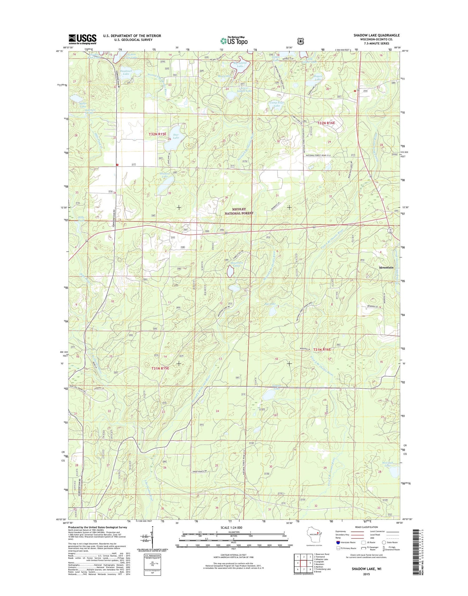
2018 topographic map quadrangle Shadow Lake in the state of Wisconsin. Scale: 1:24000. Based on the newly updated USGS 7.5' US Topo map series, this map is in the following counties: Oconto. The map contains contour data, water features, and other items you are used to seeing on USGS maps, but also has updated roads and other features. This is the next generation of topographic maps. Printed on high-quality waterproof paper with UV fade-resistant inks.
Quads adjacent to this one:
West: Langlade
Northwest: Reservoir Pond
North: Townsend
Northeast: Wheeler Lake
East: Mountain
Southeast: Breed
South: Fredenberg Lake
Southwest: Markton
Contains the following named places: Big Island Lake, Camp Four Lake, Chicken Crop Lake, Deadman Lake, Doty Fire Department, Doty Townhall, Hagen Lake, Hells Acre Springs, Hills Pond, Hills Pond Creek, Little Gillett Lake, Lost Lake, Lower Island Lake, McComb Lake, Miller Lake, Mountain Lakes, Mud Lake, Pat Lake, Second South Branch Oconto River, Shadow Lake, Star Lake, Temple Lake, Town of Doty, Wades Lake


