MyTopo
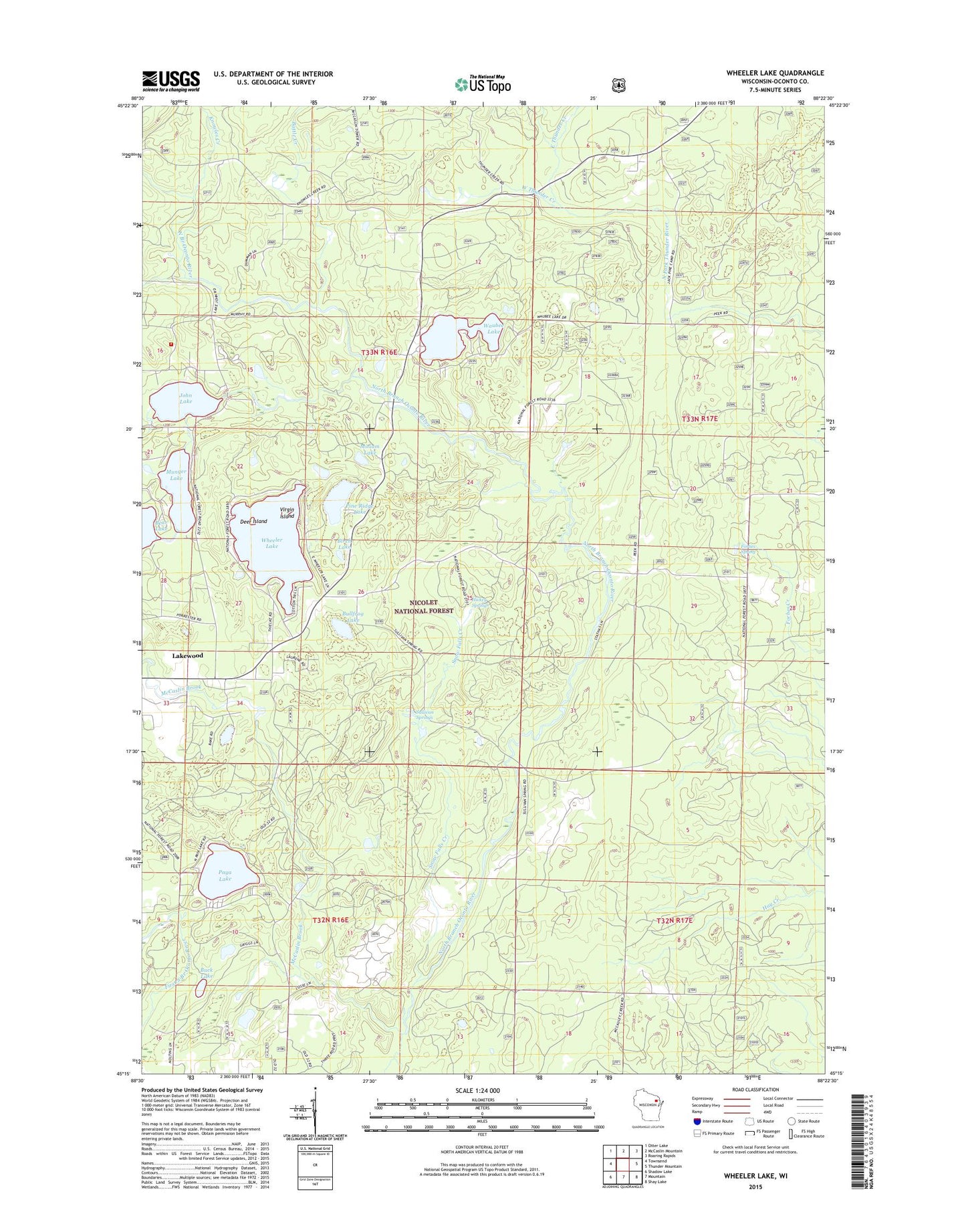
Wheeler Lake Wisconsin US Topo Map
Couldn't load pickup availability
Also explore the Wheeler Lake Forest Service Topo of this same quad for updated USFS data
2022 topographic map quadrangle Wheeler Lake in the state of Wisconsin. Scale: 1:24000. Based on the newly updated USGS 7.5' US Topo map series, this map is in the following counties: Oconto. The map contains contour data, water features, and other items you are used to seeing on USGS maps, but also has updated roads and other features. This is the next generation of topographic maps. Printed on high-quality waterproof paper with UV fade-resistant inks.
Quads adjacent to this one:
West: Townsend
Northwest: Otter Lake
North: McCaslin Mountain
Northeast: Roaring Rapids
East: Thunder Mountain
Southeast: Shay Lake
South: Mountain
Southwest: Shadow Lake
This map covers the same area as the classic USGS quad with code o45088c4.
Contains the following named places: Battle Creek, Birch Lake, Buck Lake, Bullfrog Lake, Deer Island, East Thunder Creek, Forbes Spring, Hickey Springs, John Lake, Knowles Creek, Lakewood Country Club Airport, Lakewood Volunteer Fire Department, Mary Park, McCaslin Brook, Miriam Lake, Munger Lake, Paya Lake, Pine Ridge Lake, Snow Falls Creek, Snow Falls Creek State Natural Area, Spring Creek, Sullivan Springs, Town of Lakewood, Virgin Island, Waubee Lake, West Thunder Creek, Wheeler Lake, Wheeler Lake Swimming Beach, ZIP Code: 54138