MyTopo
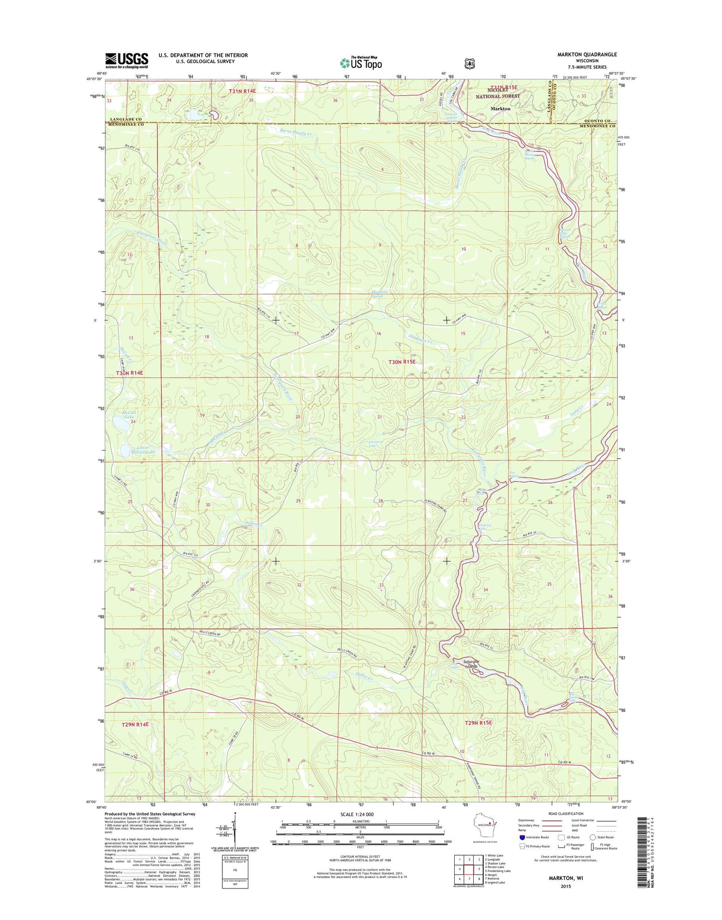
Markton Wisconsin US Topo Map
Couldn't load pickup availability
Also explore the Markton Forest Service Topo of this same quad for updated USFS data
2022 topographic map quadrangle Markton in the state of Wisconsin. Scale: 1:24000. Based on the newly updated USGS 7.5' US Topo map series, this map is in the following counties: Menominee, Langlade, Oconto. The map contains contour data, water features, and other items you are used to seeing on USGS maps, but also has updated roads and other features. This is the next generation of topographic maps. Printed on high-quality waterproof paper with UV fade-resistant inks.
Quads adjacent to this one:
West: Perote Lake
Northwest: White Lake
North: Langlade
Northeast: Shadow Lake
East: Fredenberg Lake
Southeast: Legend Lake
South: Keshena
Southwest: Neopit
This map covers the same area as the classic USGS quad with code o45088a6.
Contains the following named places: Big Smoky Falls, Burnt Shanty Creek, Burnt Shanty Rapids, Dalles Creek, Deadman Creek, Deadman Spring, Ducknest Creek, Ducknest Falls, Evergreen Falls, Evergreen River, Gilmores Mistake Rapids, Lazy Creek, Lower McCall Lake, Markton, McCall Creek, McCall Lake, Menominee County, Menominee Reservation, Saturday Islands, Shotgun Eddy Rapids, Sullivan Falls, The Dalles, Town of Menominee, Trip Rapids, Wolf Rapids