MyTopo
Shay Lake Wisconsin US Topo Map
Couldn't load pickup availability
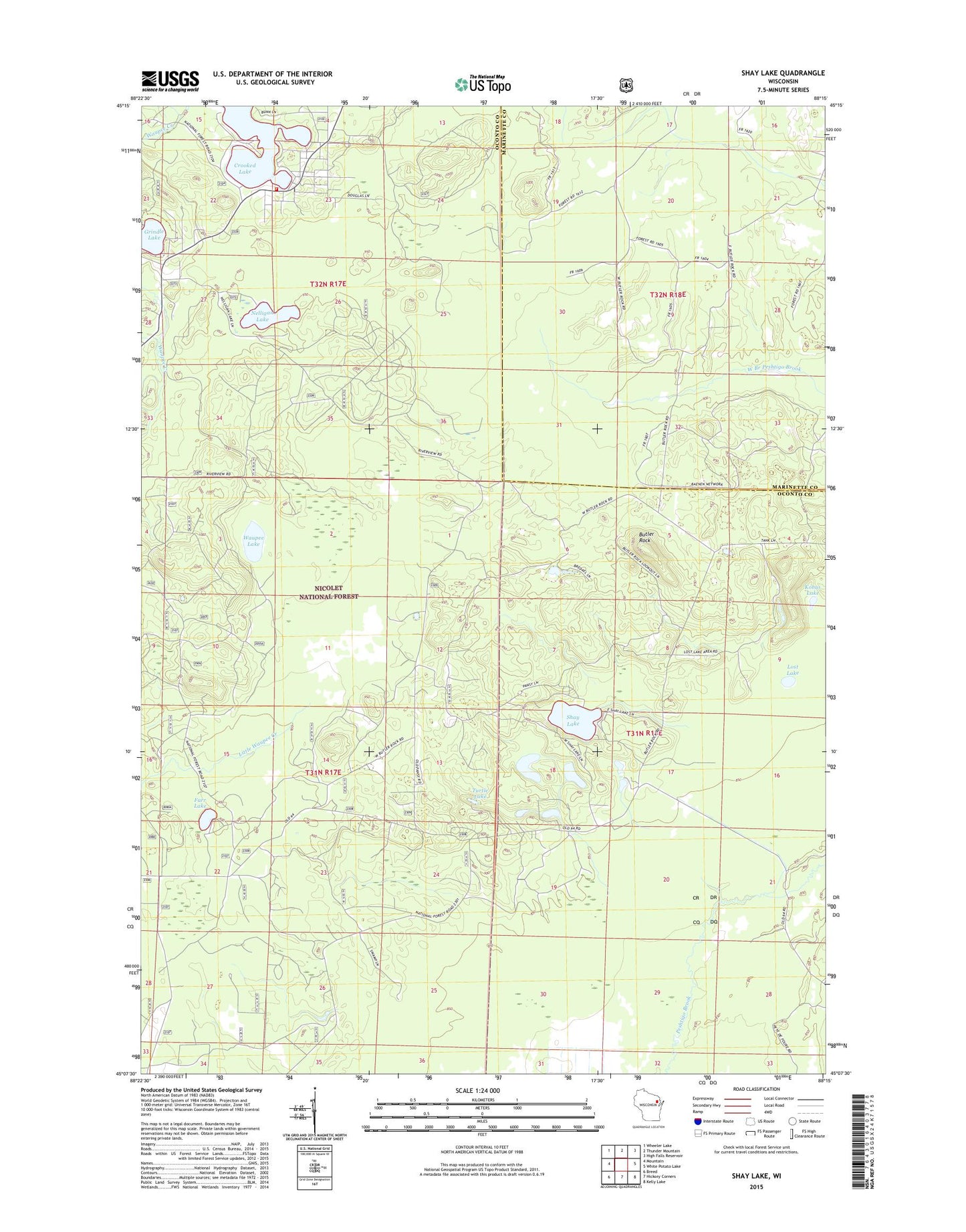
2018 topographic map quadrangle Shay Lake in the state of Wisconsin. Scale: 1:24000. Based on the newly updated USGS 7.5' US Topo map series, this map is in the following counties: Oconto, Marinette. The map contains contour data, water features, and other items you are used to seeing on USGS maps, but also has updated roads and other features. This is the next generation of topographic maps. Printed on high-quality waterproof paper with UV fade-resistant inks.
Quads adjacent to this one:
West: Mountain
Northwest: Wheeler Lake
North: Thunder Mountain
Northeast: High Falls Reservoir
East: White Potato Lake
Southeast: Kelly Lake
South: Hickory Corners
Southwest: Breed
Contains the following named places: Bass Lake, Butler Rock, Crooked Lake, Crooked Lake Volunteer Fire Department, Farr Lake, Gilkey Lake, Grindle Lake, Kobus Lake, Lost Lake, Nelligan Lake, Saint Mary of the Lake Church, Shay Lake, Turtle Lake, Waupee Lake