MyTopo
South Wayne Wisconsin US Topo Map
Couldn't load pickup availability
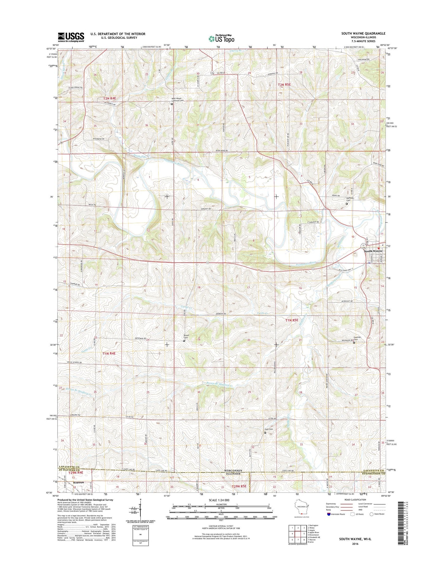
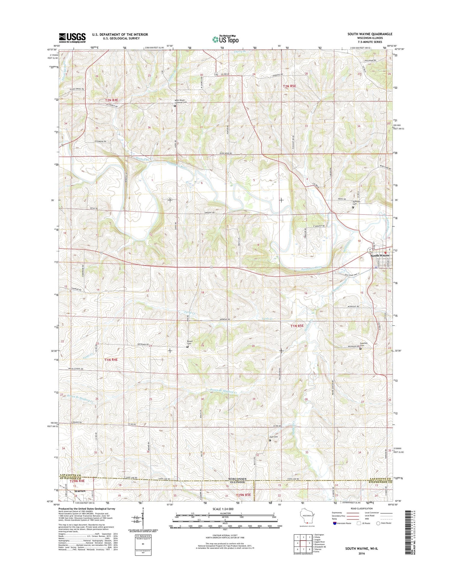
2018 topographic map quadrangle South Wayne in the state of Wisconsin. Scale: 1:24000. Based on the newly updated USGS 7.5' US Topo map series, this map is in the following counties: Lafayette, Jo Daviess, Stephenson. The map contains contour data, water features, and other items you are used to seeing on USGS maps, but also has updated roads and other features. This is the next generation of topographic maps. Printed on high-quality waterproof paper with UV fade-resistant inks.
Quads adjacent to this one:
West: Apple River
Northwest: Darlington
North: Wiota
Northeast: Argyle
East: Browntown
Southeast: Lena
South: Warren
Southwest: Elizabeth NE
Contains the following named places: Black Hawk Elementary School, Black Hawk High School, Brown Branch Spafford Creek, Brown Cemetery, Deereview Farms, Eastman Cemetery, Engebretson School, Evergreen Farm, Feather Branch, Hoffman Cemetery, Jennings School, Mud Hollow School, Porter School, Saint Pauls Church, Silver Spring Creek, South Wayne, South Wayne Fire Department, South Wayne Police Department, South Wayne Post Office, Spafford Creek, Swiss Acre Farm, Town of Wayne, Turtle Creek, Village of South Wayne, Wallace Farms, Watson School, Wayne Center School, West Wayne School, West Wiota Church, West Wiota Lutheran Cemetery, Zion Cemetery, Zion School, ZIP Code: 53587