MyTopo
Wiota Wisconsin US Topo Map
Couldn't load pickup availability
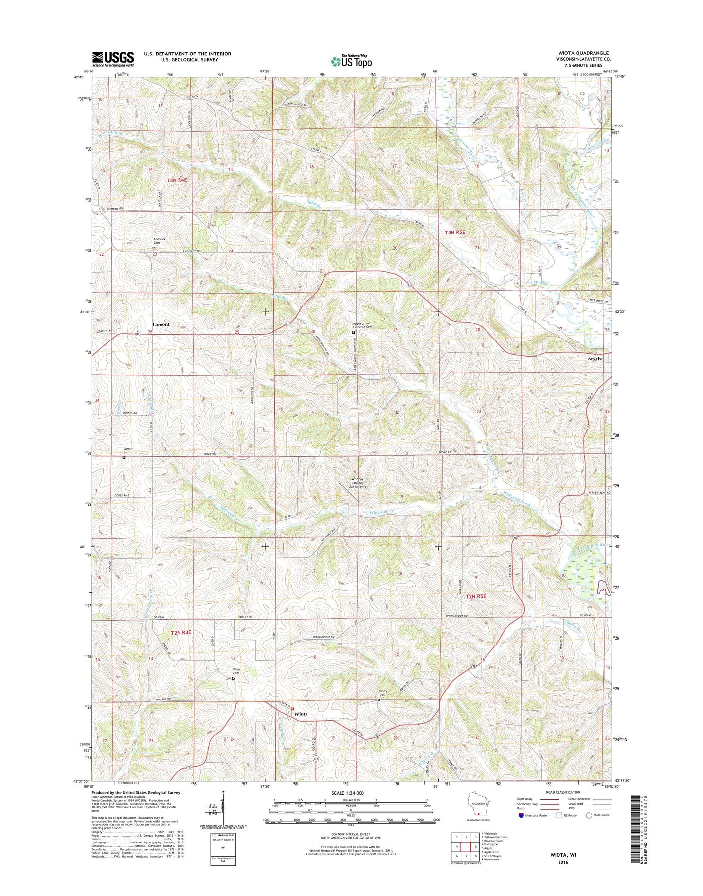
2022 topographic map quadrangle Wiota in the state of Wisconsin. Scale: 1:24000. Based on the newly updated USGS 7.5' US Topo map series, this map is in the following counties: Lafayette. The map contains contour data, water features, and other items you are used to seeing on USGS maps, but also has updated roads and other features. This is the next generation of topographic maps. Printed on high-quality waterproof paper with UV fade-resistant inks.
Quads adjacent to this one:
West: Darlington
Northwest: Waldwick
North: Yellowstone Lake
Northeast: Blanchardville
East: Argyle
Southeast: Browntown
South: South Wayne
Southwest: Apple River
This map covers the same area as the classic USGS quad with code o42089f8.
Contains the following named places: Andrews Cemetery, Apple Branch, Apple Branch Acres, Apple Grove Cemetery, Apple Grove Lutheran Church, Bloody Lake, Brennan Creek, Cherry Branch School, Cotton Wood Dairy, Cottonwood Dairy, Everson School, Five Corners, Hawley School, Hi - Ho Dairy, Holmesville Dairy, Lamont, Lamont Cemetery, Miller Cemetery, Mud Branch, Owego Stock Farm, Reuter Farms, Riverside Dairy, Silver Creek Family Farms, Town of Argyle, Town of Wiota, Trinity Johnson Cemetery, Turry Farms, Van Meter School, Whiteside Creek, Whoopy Hollow Aerodrome, Wiota, Wiota Census Designated Place, Wiota Volunteer Fire Department, Yellowstone River