MyTopo
Darlington Wisconsin US Topo Map
Couldn't load pickup availability
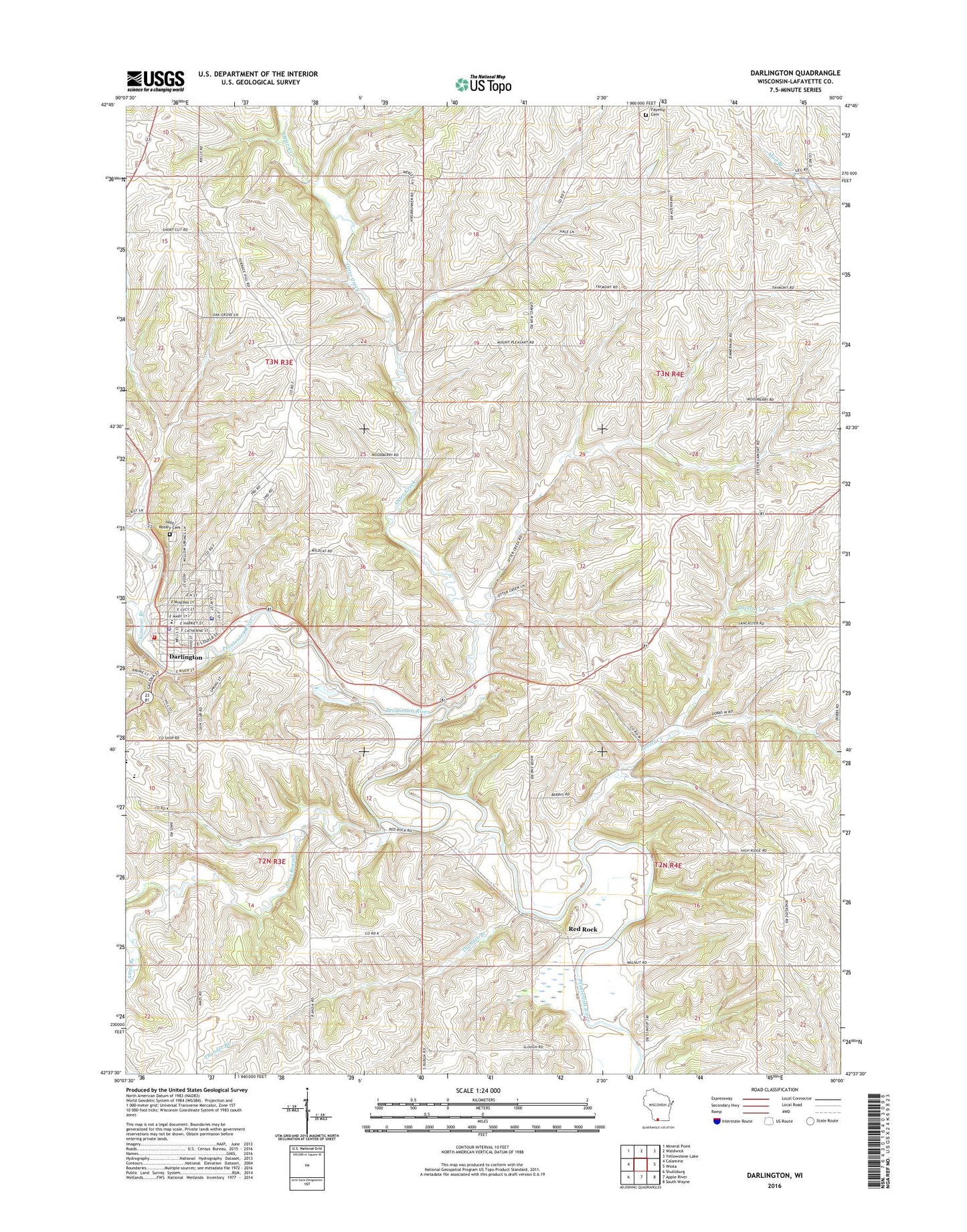
2022 topographic map quadrangle Darlington in the state of Wisconsin. Scale: 1:24000. Based on the newly updated USGS 7.5' US Topo map series, this map is in the following counties: Lafayette. The map contains contour data, water features, and other items you are used to seeing on USGS maps, but also has updated roads and other features. This is the next generation of topographic maps. Printed on high-quality waterproof paper with UV fade-resistant inks.
Quads adjacent to this one:
West: Calamine
Northwest: Mineral Point
North: Waldwick
Northeast: Yellowstone Lake
East: Wiota
Southeast: South Wayne
South: Apple River
Southwest: Shullsburg
This map covers the same area as the classic USGS quad with code o42090f1.
Contains the following named places: Ames Branch, City of Darlington, Darlington, Darlington Aviation Inc Airport, Darlington Elementary / Middle School, Darlington High School, Darlington Police Department, Darlington Post Office, Darlington Volunteer Fire Department, Davis Family Farm, Dobbs School, Fayette Cemetery, First Baptist Church, Fitzsimons Dairy Farm, Godfrey Farm, Gravel Run Creek, Holy Rosary Catholic School, Holy Rosary Cemetery, Holy Rosary Church, Immanuel United Church of Christ, Johnson Public Library, Kingdom Hall of Jehovahs Witnesses, Lafayette County Sheriff's Office, Lovett Creek, Memorial Hospital of Lafayette County, Mosley Farms, Otter Creek, Otter Creek Farms, Otter Creek School, Paper School, Rear Farm, Red Rock, Red Rock View Farms, Rielly Farm, Rural Metro Corporation, Schilling Farm, Siegenthaler Dairy, Thunder Branch, Thunderbranch Acres, Town of Darlington, Town of Lamont, Vinegar Branch, Willow Springs School, ZIP Code: 53530