MyTopo
Apple River Illinois US Topo Map
Couldn't load pickup availability
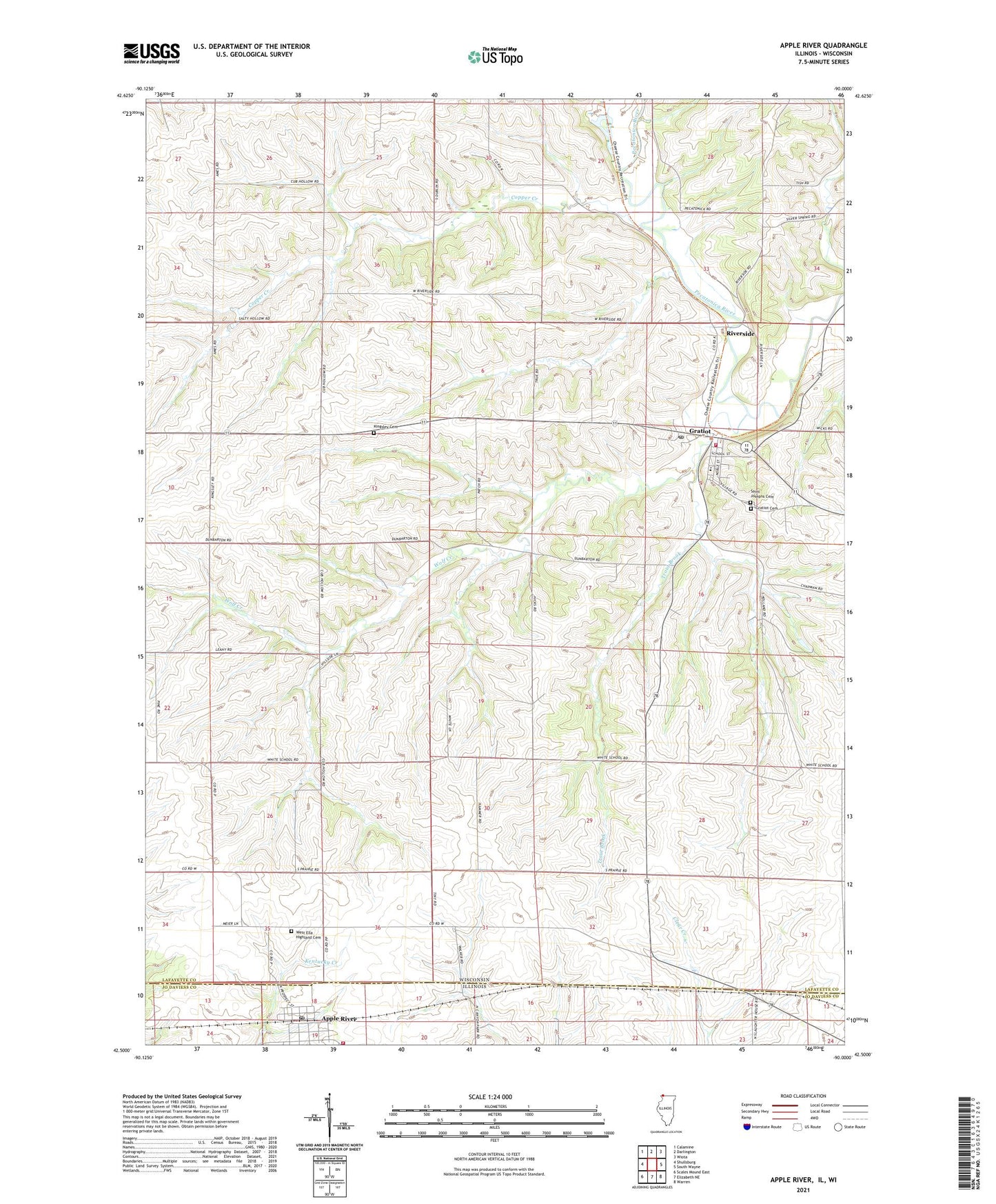
2024 topographic map quadrangle Apple River in the states of Wisconsin, Illinois. Scale: 1:24000. Based on the newly updated USGS 7.5' US Topo map series, this map is in the following counties: Jo Daviess, Lafayette. The map contains contour data, water features, and other items you are used to seeing on USGS maps, but also has updated roads and other features. This is the next generation of topographic maps. Printed on high-quality waterproof paper with UV fade-resistant inks.
Quads adjacent to this one:
West: Shullsburg
Northwest: Calamine
North: Darlington
Northeast: Wiota
East: South Wayne
Southeast: Warren
South: Elizabeth NE
Southwest: Scales Mound East
Contains the following named places: 0.37 Reservoir, 1 Reservoir, 53541, Apple River, Apple River Fire Department, Apple River Post Office, Apple River United Methodist Church, Black Hawk Middle School, Brannon School, Copper Creek, D and S Farms, Davis Farms, Dublin School, Ernst Dairy, Gill Brothers Dairy, Gratiot, Gratiot Cemetery, Gratiot Post Office, Gratiot Volunteer Fire Department, Hi View Farm, Johnny Cake School, Kingsley Cemetery, Levitt School, Metz Number 1 G9922 Dam, Metz Number 2 G9922 Dam, Monson Udder Farms, Red Rock School, Riverside, Robelia Dairy Farms, Saint Josephs Church, Salty Hollow School, Silent Hollow Farm, Spring Valley Dairy, Stietz Farms, Town of Gratiot, Trout Brook, Village of Apple River, Village of Gratiot, West Ella Highland Cemetery, Whitcomb Farms, Wolf Creek