MyTopo
Spider Lake Wisconsin US Topo Map
Couldn't load pickup availability
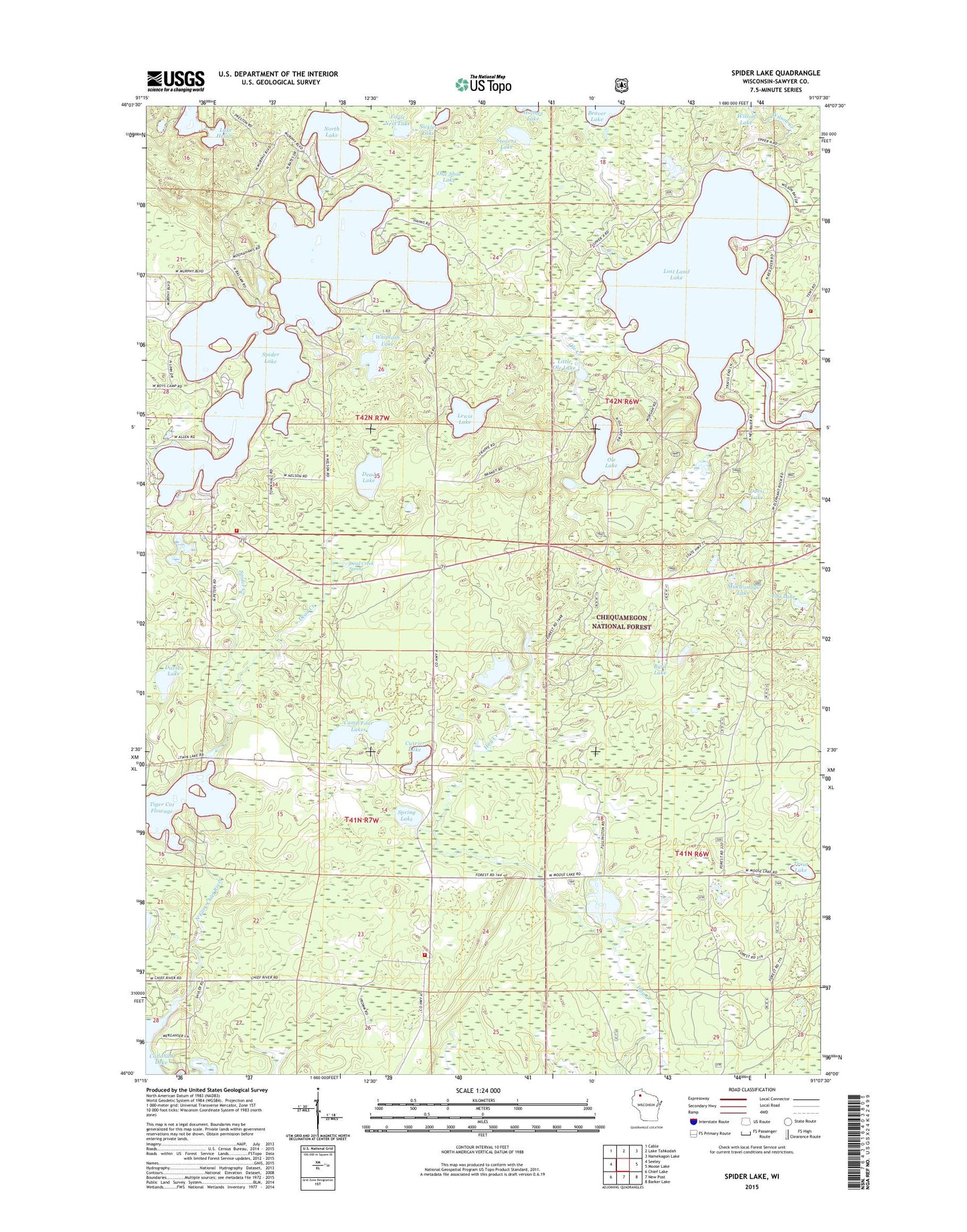
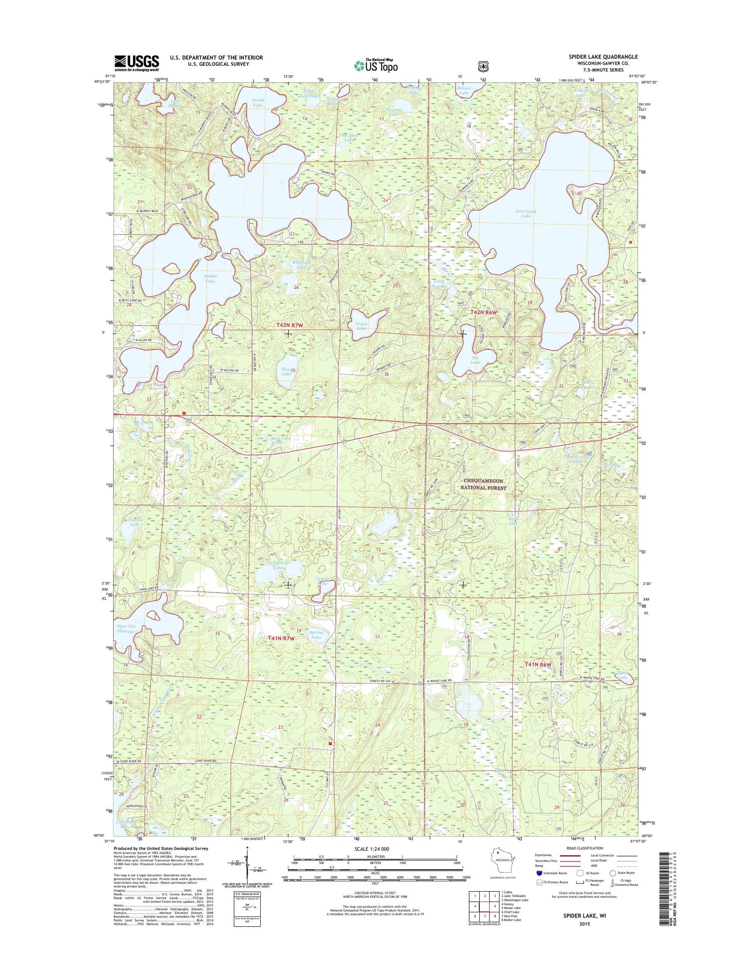
2018 topographic map quadrangle Spider Lake in the state of Wisconsin. Scale: 1:24000. Based on the newly updated USGS 7.5' US Topo map series, this map is in the following counties: Sawyer. The map contains contour data, water features, and other items you are used to seeing on USGS maps, but also has updated roads and other features. This is the next generation of topographic maps. Printed on high-quality waterproof paper with UV fade-resistant inks.
Quads adjacent to this one:
West: Seeley
Northwest: Cable
North: Lake Tahkodah
Northeast: Namekagon Lake
East: Moose Lake
Southeast: Barker Lake
South: New Post
Southwest: Chief Lake
Contains the following named places: Byrd Lake, Camp Four Lakes, Chief River State Wildlife Management Area, Clear Lake, Currier Lake, Davies Lake, Davis Lake, Dead Creek, Dead Creek Spring, Dead Lake, Eagle Nest Lake, Fawn Lake, Foo Lake, Lake Helane, Lake School, Larson Lake, Lewis Lake, Little Ole Lake, Lost Land Lake, Lost Land Lake Club, Mukwonago Lake, North Lake, Ole Creek, Ole Lake, One Shoe Lake, Rush Lake, Sickles Lake, Spider Creek, Spider Lake, Spider Lake Fire Department Station 1, Spider Lake Fire Department Station 2, Spider Lake School, Spider Lake Townhall, Spring Lake, Stearns Lake, Tiger Cat 2WP255 Dam, Tiger Cat Dam, Tiger Cat Flowage 47, Town of Round Lake, Town of Round Lake Fire Department - Station 2, Trout Lake, Whiplash Lake, Wilson Creek