MyTopo
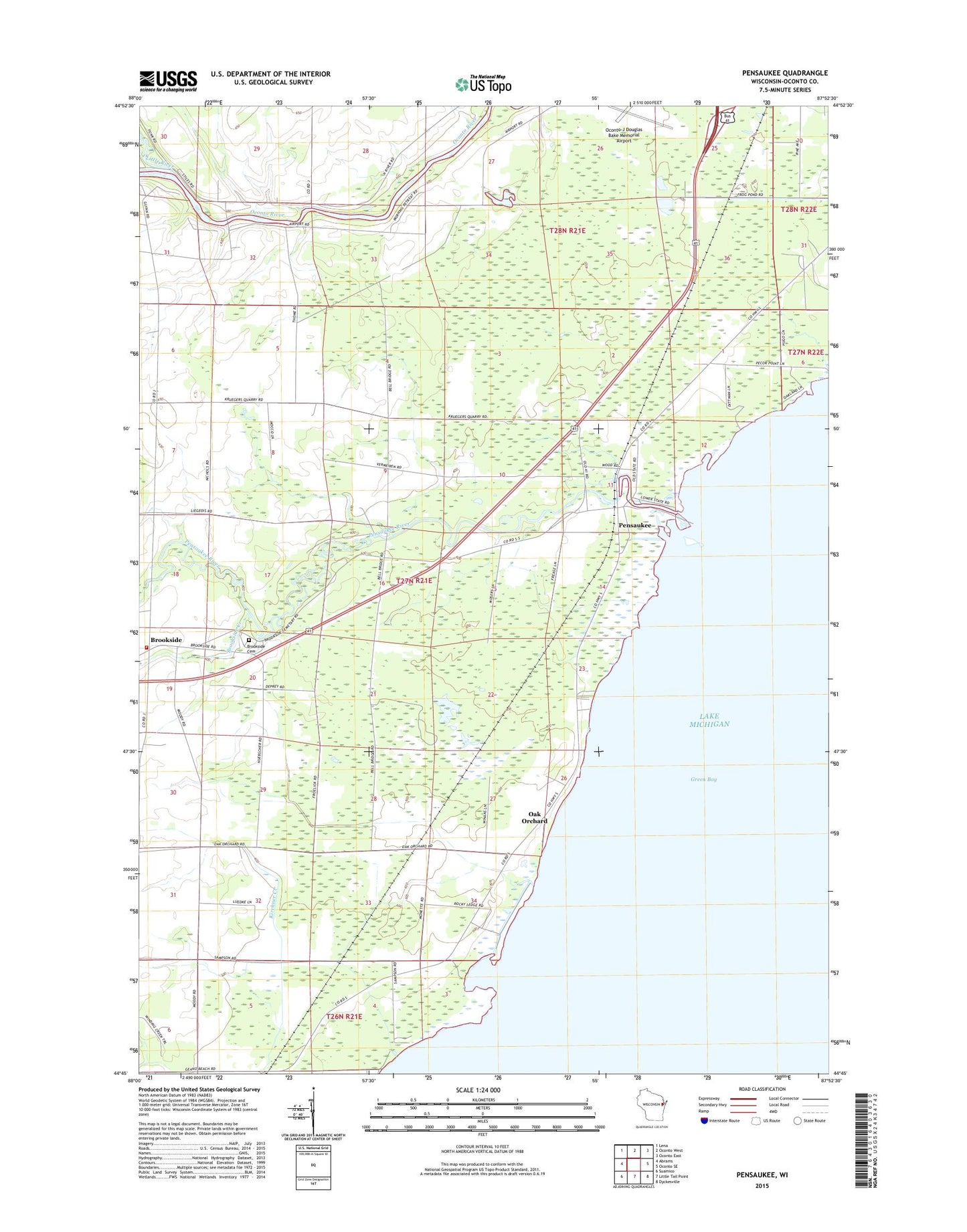
Pensaukee Wisconsin US Topo Map
Couldn't load pickup availability
2022 topographic map quadrangle Pensaukee in the state of Wisconsin. Scale: 1:24000. Based on the newly updated USGS 7.5' US Topo map series, this map is in the following counties: Oconto. The map contains contour data, water features, and other items you are used to seeing on USGS maps, but also has updated roads and other features. This is the next generation of topographic maps. Printed on high-quality waterproof paper with UV fade-resistant inks.
Quads adjacent to this one:
West: Abrams
Northwest: Lena
North: Oconto West
Northeast: Oconto East
East: Oconto SE
Southeast: Dyckesville
South: Little Tail Point
Southwest: Suamico
This map covers the same area as the classic USGS quad with code o44087g8.
Contains the following named places: Brick School, Brookside, Brookside Cemetery, Brookside Creek, Brookside Station, Charles Pond State Natural Area, Charles Pond State Public Hunting Grounds, Couillardville School, Little River, Oak Orchard, Pensaukee, Pensaukee Census Designated Place, Pensaukee Fire Department, Pensaukee Harbor Light, Pensaukee River, Pensaukee State Public Hunting Grounds, Town of Pensaukee