MyTopo
Saint Germain Wisconsin US Topo Map
Couldn't load pickup availability
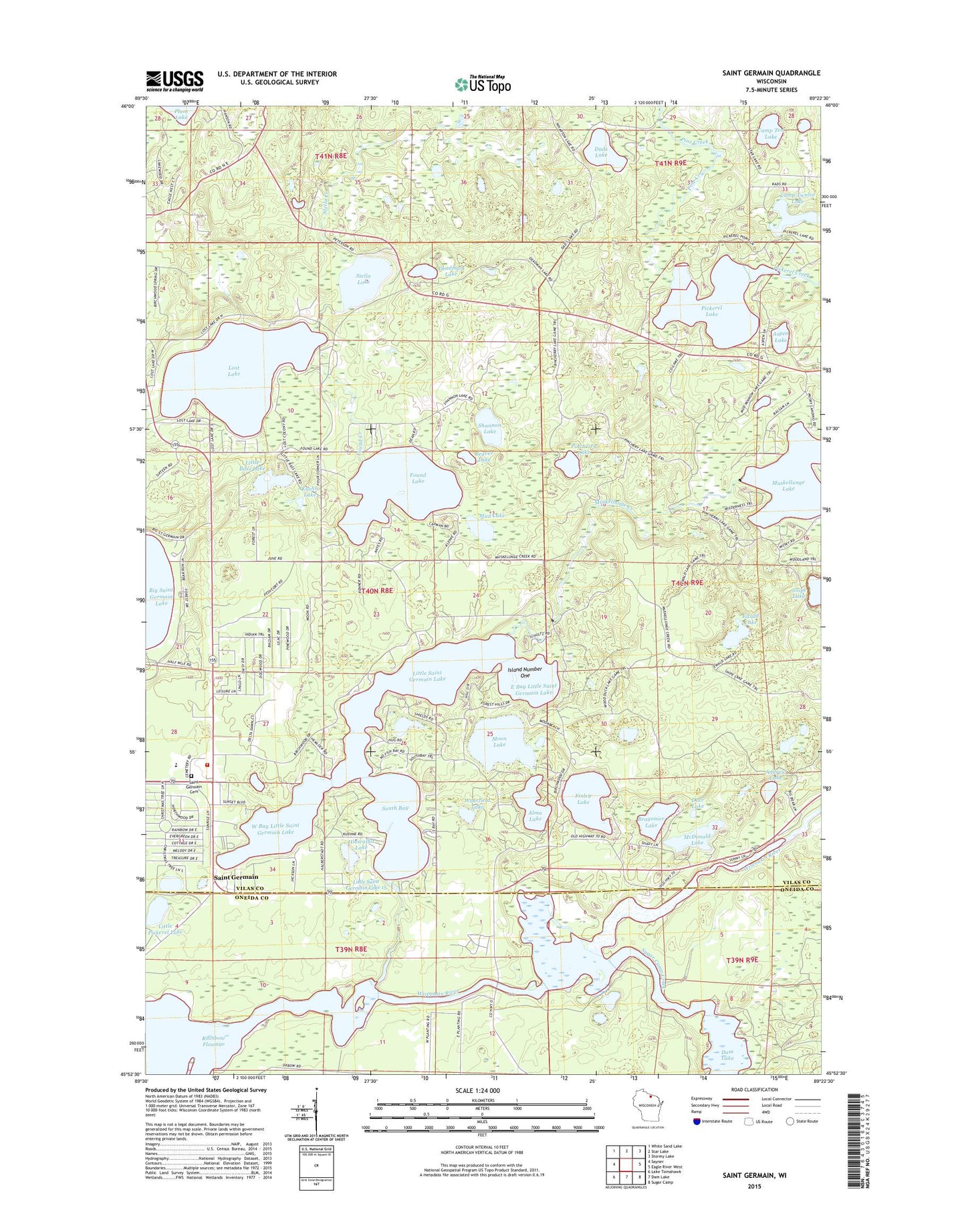
2022 topographic map quadrangle Saint Germain in the state of Wisconsin. Scale: 1:24000. Based on the newly updated USGS 7.5' US Topo map series, this map is in the following counties: Vilas, Oneida. The map contains contour data, water features, and other items you are used to seeing on USGS maps, but also has updated roads and other features. This is the next generation of topographic maps. Printed on high-quality waterproof paper with UV fade-resistant inks.
Quads adjacent to this one:
West: Sayner
Northwest: White Sand Lake
North: Star Lake
Northeast: Stormy Lake
East: Eagle River West
Southeast: Sugar Camp
South: Dam Lake
Southwest: Lake Tomahawk
This map covers the same area as the classic USGS quad with code o45089h4.
Contains the following named places: Alma Lake, Andrew Lake, Aspen Lake, Beaver Lake, Bragonier Lake, Camp Ten Lake, Camp Twelve Lake, Dads Lake, Deadman Lake, Deer Lake, East Bay Little Saint Germain Lake, Ewald Lake, Finley Lake, Found Creek, Found Lake, Found Lake School, Hiawatha Lake, Highway G Landfill and Waste Processing Facility, Island Number One, Jackson School, Kuehn Lake, Little Bass Lake, Little Mamie Lake, Little Pickerel Lake, Little Saint Germain Creek, Little Saint Germain Dam, Little Saint Germain Lake, Lost Lake, McDonald Lake, Moon Lake, Mud Lake, Muskellunge Creek, Muskellunge Lake, Pickerel Lake, Pickerel Lookout Tower, Pincherry Lake, Pine Creek, Saint Germain, Saint Germain Cemetery, Saint Germain Elementary School, Saint Germain Fire and Rescue Department, Saint Germain Post Office, Shannon Lake, South Bay, Stella Creek, Stella Lake, Sugar Camp Creek, Town of Saint Germain, Wakefield Lake, West Bay Little Saint Germain Lake, ZIP Code: 54558